
Home > Juniper

Juniper systems and the Bench Mark advantage
Juniper is an industry-leading provider of ultra-rugged data collectors, precision GPS receivers, and niche-market software solutions. Founded in 1993 by an industry professional, Juniper Systems back their products with extensive experience and ongoing innovation. The Juniper Allegro 2 is one of the best-selling products at Bench Mark, but we are pleased to supply several reliable and high-quality products from the Juniper brand.
Showing all 14 results


Juniper Systems manufactures rugged field computers, GNSS receivers, and data collectors used for surveying, GIS data collection, mapping, and environmental field work.
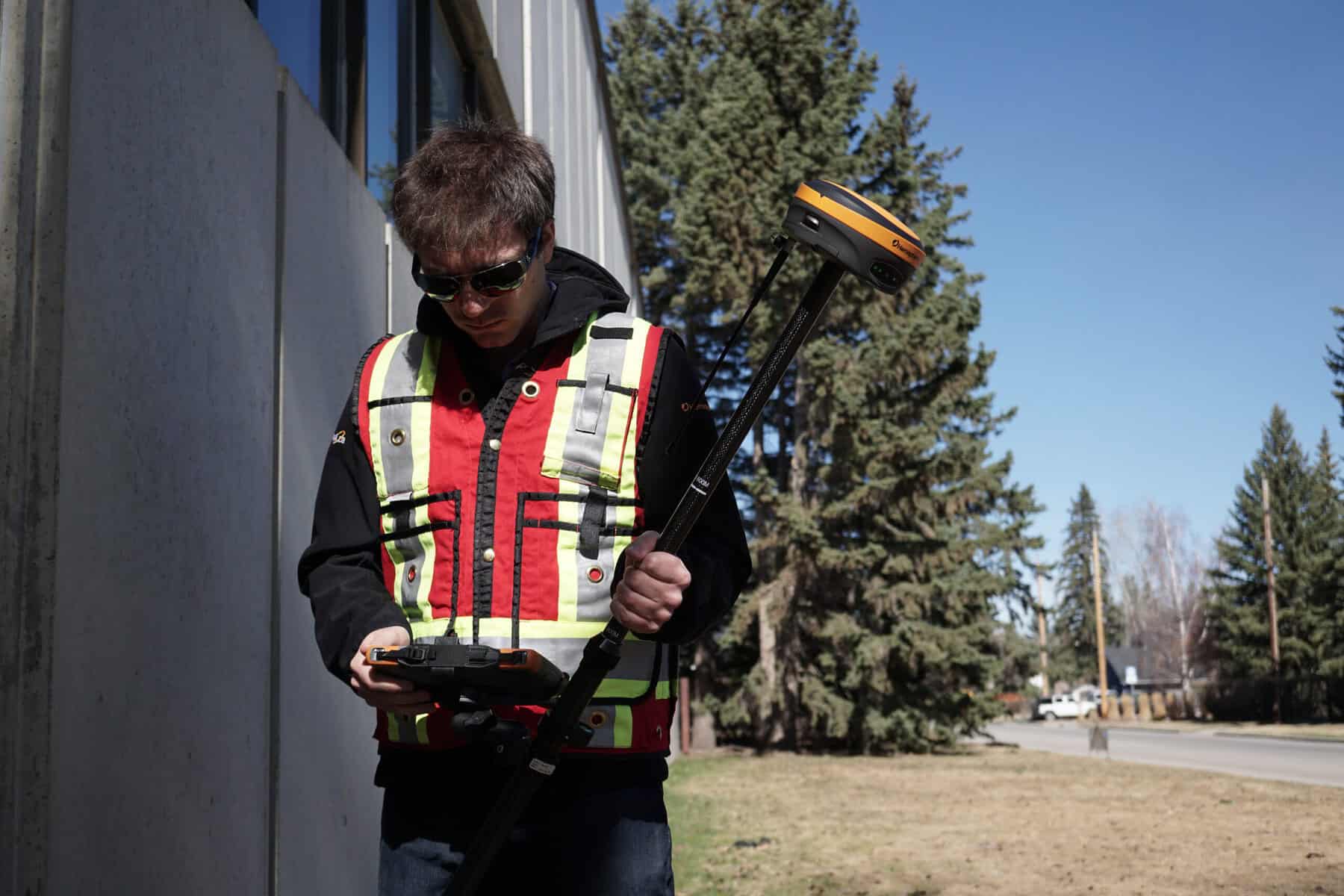
The Mesa and Archer series are rugged handheld data collectors designed for field environments. They allow surveyors and GIS professionals to run mapping software, collect field data, and connect to GNSS receivers and other instruments.
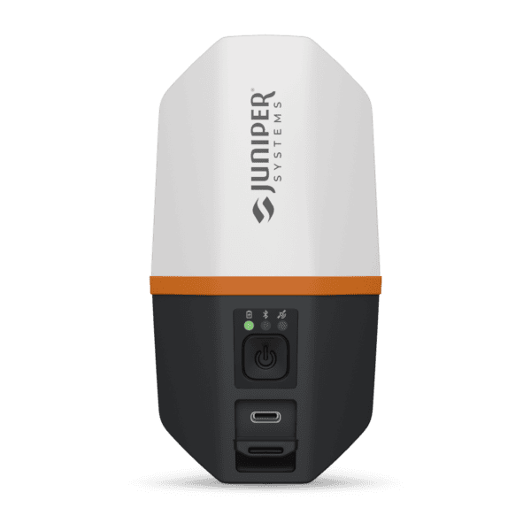
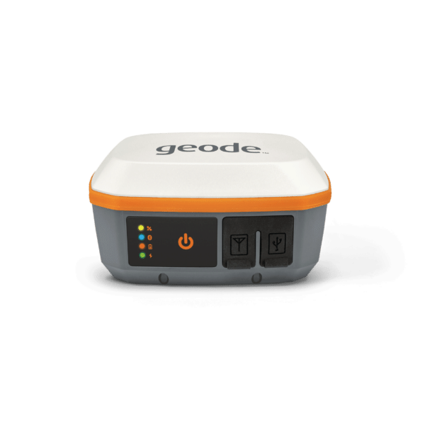
The Juniper Geode GNSS receiver is designed for sub-meter GIS data collection. It pairs with field tablets or data collectors to capture location data for mapping, asset management, and environmental surveys.
Yes. Juniper field computers can run many surveying and GIS applications, allowing users to connect GNSS receivers and manage field data directly from the device.
Rugged field devices are built to withstand dust, moisture, vibration, and extreme temperatures, making them suitable for demanding outdoor environments where standard consumer tablets may fail.
Juniper devices are widely used in land surveying, GIS mapping, utilities, environmental monitoring, construction, and asset management.
Everything you need to know
Selecting the right Juniper solution depends on your workflow, accuracy requirements, and field conditions.
1. Define Your Application
Data collection → Rugged handhelds like Allegro series
GNSS positioning → Juniper Geode GNSS receivers
2. Determine Accuracy Needs
Sub-meter to centimeter → GNSS solutions
High consistency in field data → Integrated data collectors
3. Evaluate Field Conditions
Extreme environments → Ultra-rugged devices
Remote locations → Long battery life + reliable connectivity
4. Consider Workflow Integration
Ensure compatibility with your GNSS systems, software, and data processing tools.
5. Budget & Scalability
Juniper offers cost-effective solutions that can scale with your operational needs over time.

Feature | Juniper Systems | Leica Geosystems | Trimble | Topcon |
Primary Focus | Rugged data collectors & GNSS | High-end surveying systems | GNSS & enterprise solutions | GNSS + construction |
Durability | ✔ Ultra-rugged | ✔ | ✔ | ✔ |
Ease of Use | ⭐⭐⭐⭐⭐ (very intuitive) | ⭐⭐⭐⭐ | ⭐⭐⭐⭐ | ⭐⭐⭐⭐ |
GNSS Capability | ✔ Strong (juniper gnss) | ✔ Industry-leading | ✔ | ✔ |
Portability | ✔ Lightweight & field-ready | ✔ | ✔ | ✔ |
Integration | ✔ Flexible & open | ✔ | ✔ | ✔ |
Price | 💲💲💲 (great value) | 💲💲💲💲 | 💲💲💲💲 | 💲💲💲 |
Best For | Rugged fieldwork & data collection | Premium precision | Large-scale workflows | Construction-heavy projects |
Surveying, construction, engineering, and mapping workflows
Juniper equipment supports a wide range of industries where durability and accuracy are essential.
Land Surveying
Professionals rely on Juniper GPS solutions for boundary surveys, topographic mapping, and control point measurements.
GIS & Mapping
Juniper devices enable efficient geospatial data collection across large areas, ensuring accuracy and consistency.
Construction & Site Work
Rugged data collectors support layout, verification, and on-site measurements in dynamic construction environments.
Environmental & Field Research
Ideal for remote fieldwork, where equipment must perform reliably in unpredictable conditions.
Utilities & Infrastructure
Used for asset mapping, inspections, and maintenance of critical infrastructure systems.

Rugged field devices for reliable data collection and positioning
Juniper Systems devices are built for professionals who need durable, easy-to-use tools for data collection and positioning in demanding environments. These systems support GNSS workflows, real-time data capture, and seamless integration with surveying software.
Designed for reliability in tough field conditions, Juniper equipment helps teams maintain accuracy, improve efficiency, and work with confidence across different project types.
What We Offer
This approach ensures your equipment performs consistently and supports your workflow in the field.