Search
Close this search box.
Search
Close this search box.

Juniper Uinta GIS Software

Uinta, the brainchild of Juniper Systems, revolutionizes GIS mapping and data collection, offering an intuitive interface that simplifies intricate tasks across diverse industries. As a GIS analyst, Uinta’s user-friendly design is a game-changer in utility asset mapping, local government asset management, and irrigation mapping. Its specialized templates streamline complex processes, enabling accurate mapping without the need for navigating through convoluted software. From utility pole inspections to natural resource management and equine recordkeeping, Uinta’s straightforward approach enhances data collection and analysis efficiency. It’s a versatile tool that aligns functionality with simplicity, empowering GIS professionals to execute tasks seamlessly and with precision, tailored to the specific demands of our industry.

Uinta’s user-centric interface bridges the gap between intricate GIS functionalities and ease of use. As GIS analysts, Uinta empowers us to elevate our workflows, providing a seamless, accessible platform for GIS mapping and data collection. With Uinta, we focus on our analyses and projects with precision and efficiency, leveraging its intuitive design to navigate complex tasks effortlessly.

Additional product info

Detailed quote form

Request A Free Quote – Juniper Uinta

"*" indicates required fields

Uinta Version

Select Package

Data Collector

Select Package
Name*
Call In?
Receive text messages from us?

By submitting this form, you hereby agree to receive communications from Bench Mark

Product details

  • Efficient Data Capture
  • Professional Mapping
  • Advanced Customization
  • Cloud Support

Package includes

  • GNSS
  • Custom Project Formats
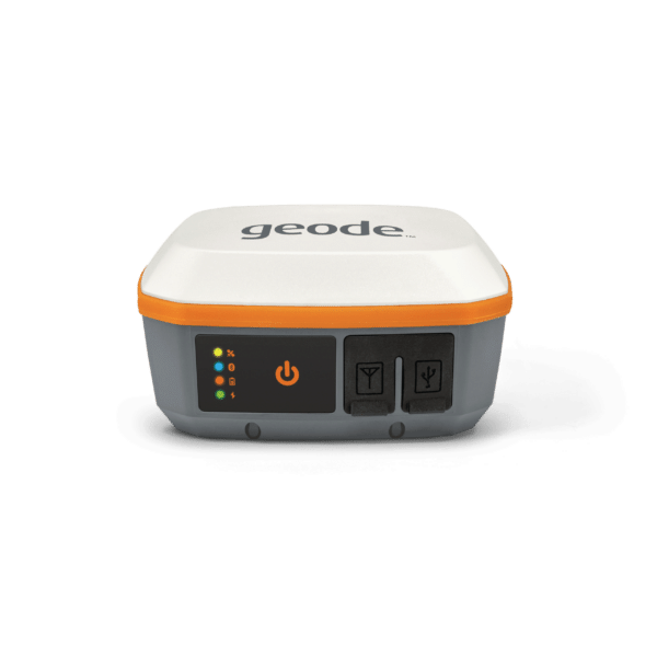
  • Geode and S631 Compatible
  • Can Take GNSS NMEA Strings
  • Android and Windows Compatible

Description

Uinta: Advanced GIS Data Collection

Welcome to Uinta by Juniper Systems, where ease of use meets boundless functionality in GIS mapping and data collection. We understand the frustrations of navigating through complex software, which is why Uinta stands as a beacon of simplicity and efficiency.

Utility asset mapping becomes a breeze with Uinta’s intuitive interface. From transformers to valves and gas lines, our specialized templates allow for accurate mapping without the headache of intricate software. Create standardized PDF map reports effortlessly, sharing comprehensive GIS files with customers in a snap.

Local governments and municipalities find solace in Uinta’s straightforward approach. Our templates cater to managing public assets such as maintenance, parks, and utilities, simplifying asset management and facilitating seamless integration with existing GIS systems.

Commercial irrigation mapping? Water audits? Uinta streamlines these tasks with its user-friendly design. From mapping valves to generating detailed reports including equipment lists and photos, it ensures clear communication with customers without the complexities typically associated with such processes.

Utility pole mapping and inspection? Uinta’s custom templates expedite data collection without the need for extensive training. Easily modify templates to fit specific job requirements, exporting data in familiar formats like Microsoft Excel for effortless collaboration.

Natural resources management made easy – that’s Uinta’s promise. Whether it’s range management or wildlife surveys, our templates streamline data capture and analysis, empowering researchers without unnecessary software intricacies.

Industrial asset inspections? Uinta simplifies compliance with regulatory requirements, offering user-friendly templates for asset tracking and inspections, ensuring hassle-free operations without compromising on accuracy.

Harbor management professionals rejoice with Uinta’s simplicity in mooring layout plans and navigation. Combined with our high-accuracy Geode Real-time Sub-meter GPS Receiver, it ensures accurate buoy placements and navigation without the need for extensive training or complex software manipulation.

Even in equine management and recordkeeping, Uinta’s ease of use shines through. Custom templates cater to various equine practices, digitizing records and streamlining processes without overwhelming complexities.

Uinta isn’t just a tool – it’s your ally in simplifying complex tasks across industries. Experience Uinta’s effortless interface, transforming GIS mapping and data collection into a user-friendly, yet powerful, experience tailored to your specific needs.

Reviews

There are no reviews yet.

Be the first to review “Juniper Uinta GIS Software”

Your email address will not be published. Required fields are marked *