

Home > Hemisphere

About the Hemisphere brand
Hemisphere GNSS systems are used globally across surveying, marine, agriculture, and machine control applications where reliable positioning is essential. With over 20 years of innovation, the brand offers a range of receivers, smart antennas, and OEM solutions designed for flexibility and consistent performance.
These systems are built to deliver accurate results while remaining easy to integrate into different workflows, whether as standalone units or part of larger positioning systems.
Key Advantages
This combination helps ensure consistent accuracy, efficient workflows, and reliable performance in the field.
Hemisphere survey equipment includes GNSS receivers, RTK systems, smart antennas, GPS antennas, heading sensors, and positioning solutions used for land surveying, mapping, construction layout, marine navigation, agriculture, and machine control.
At Bench Mark, we carry Hemisphere survey equipment for users who need reliable positioning, strong value, and expert support before and after purchase.
Showing 1–16 of 46 results


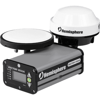


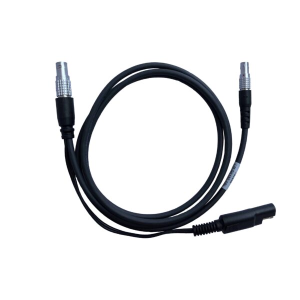
Hemisphere GNSS develops high-precision positioning technology including RTK GNSS receivers, smart antennas, GNSS compasses, and precision antennas. These systems are widely used in land surveying, marine navigation, GIS mapping, construction layout, and other applications that require accurate positioning.
Accuracy depends on the correction method used. Standard GNSS positioning typically provides meter-level accuracy, while correction services such as WAAS can improve accuracy to about 30–50 cm. When using RTK corrections or post-processing, Hemisphere GNSS receivers can achieve centimeter-level accuracy suitable for surveying and engineering applications.
Atlas is Hemisphere’s global L-band GNSS correction service that delivers high-accuracy positioning without requiring a local RTK base station. It is commonly used in marine navigation, agriculture, and mapping applications where reliable real-time corrections are needed over large areas.
One of the most popular receivers for surveying applications is the Hemisphere S631 RTK. This receiver supports multi-constellation GNSS tracking and RTK corrections to deliver reliable centimeter-level positioning, even in challenging environments such as tree canopy or obstructed areas.
Hemisphere produces a wide range of positioning solutions including RTK GNSS receivers, smart antennas, GNSS compasses, heading sensors, and precision GNSS antennas designed for surveying, marine, industrial, and navigation applications.
Hemisphere GNSS systems are used across many industries, including land surveying, construction, marine navigation, agriculture, GIS mapping, and machine control, where reliable positioning and navigation data are required.
Everything you need to know
Selecting the right Hemisphere solution depends on your specific application and accuracy requirements.
1. Define Your Application
Surveying → Hemisphere GPS Receiver with RTK capability
Marine → Hemisphere GPS Antenna systems
Machine control → Integrated GNSS solutions
2. Determine Accuracy Requirements
Centimeter-level → RTK GNSS systems
Sub-meter → Standard GNSS positioning
3. Consider Integration Needs
OEM integration → Board-level GNSS solutions
Stand-alone use → Complete receiver systems
4. Evaluate Field Conditions
Harsh environments → Rugged GNSS hardware
Mobile operations → Lightweight and flexible systems
5. Budget & Scalability
Hemisphere offers scalable solutions that grow with your operational requirements while maintaining cost efficiency.

Feature | Hemisphere GNSS | Leica Geosystems | Trimble | Topcon |
Primary Focus | GNSS & OEM positioning | High-end surveying systems | GNSS & enterprise solutions | GNSS + construction |
Accuracy | ✔ High precision (RTK) | ✔ Industry-leading | ✔ | ✔ |
Ease of Use | ⭐⭐⭐⭐⭐ (simple setup) | ⭐⭐⭐⭐ | ⭐⭐⭐⭐ | ⭐⭐⭐⭐ |
Integration | ✔ Strong OEM & machine control | ✔ | ✔ | ✔ |
Product Range | GNSS receivers, antennas, software | Full ecosystem | GNSS-focused | GNSS + construction |
Durability | ✔ Field-ready design | ✔ | ✔ | ✔ |
Price | 💲💲 (excellent value) | 💲💲💲💲 | 💲💲💲💲 | 💲💲💲 |
Best For | Cost-effective precision GNSS | Premium accuracy | Large-scale workflows | Construction focus |
The Hemisphere S631 RTK is a popular choice for surveyors who need a compact GNSS receiver for base, rover, and RTK workflows. It is used for land surveying, topographic mapping, construction layout, and control work where accurate positioning is required.
The S631 is designed for professional GNSS fieldwork and supports RTK correction workflows, making it a strong option for survey crews that need reliable performance in real-world surveying conditions.
Application | Recommended Hemisphere equipment |
Land surveying | RTK GNSS receivers such as the Hemisphere S631 |
Boundary and topographic surveys | GNSS rover and base/rover RTK systems |
Construction layout | RTK receivers with field controller and survey software |
Marine navigation | Hemisphere Vector GNSS receivers and heading antennas |
Machine control | Integrated GNSS positioning and heading solutions |
GIS mapping | GNSS receivers and smart antennas for field data collection |
Harsh field conditions | Rugged Hemisphere receivers with reliable correction options |
Surveying, construction, engineering, and mapping workflows
Hemisphere GNSS systems are widely used across industries that require precise and reliable positioning data.
Land Surveying
Hemisphere Survey Equipment is used for boundary surveys, topographic mapping, and control measurements requiring high accuracy.
Precision Agriculture
GNSS receivers enable accurate guidance, field mapping, and optimization of farming operations.
Marine Navigation
Hemisphere GPS Antenna and receiver systems provide dependable navigation and positioning for marine environments.
Construction & Machine Control
Integrated GNSS solutions support automated machine guidance and site positioning.
Aerial & UAV Applications
Used for drone navigation, aerial mapping, and data collection in geospatial projects.


Reliable GNSS solutions with expert support and real field experience
Hemisphere GNSS systems are designed to deliver accurate positioning for surveying and other precision applications. We focus on matching the right technology to your workflow, helping you achieve reliable results while maintaining efficiency and value.
With strong product knowledge and hands-on experience, we help ensure your GNSS equipment performs consistently in real field conditions.
What We Offer
This approach helps ensure your equipment is properly configured and ready to perform when it matters most.