
Home > GEOMAX

GeoMax and Bench Mark
GeoMax is a well-established brand in construction and surveying, offering a full range of instruments including GNSS receivers, total stations, levels, controllers, and software. These systems are designed to deliver accurate results while remaining simple to operate and reliable in real field conditions.
We help make GeoMax equipment accessible with full support and training, ensuring it integrates smoothly into your workflow.
Key Advantages
This combination helps improve productivity, reduce downtime, and maintain consistent accuracy across projects.
Showing all 8 results


GeoMax is a manufacturer of professional surveying and construction measurement equipment, including GNSS RTK receivers, total stations, rotating lasers, and field software used for land surveying and construction layout.
Yes. GeoMax GNSS receivers support RTK positioning, allowing surveyors to achieve centimeter-level accuracy for applications such as boundary surveys, construction layout, and engineering measurements.
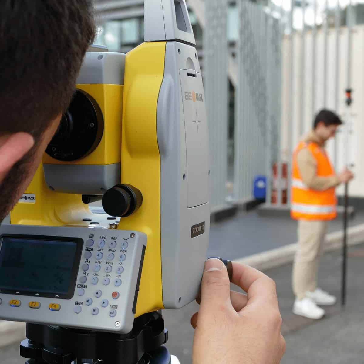
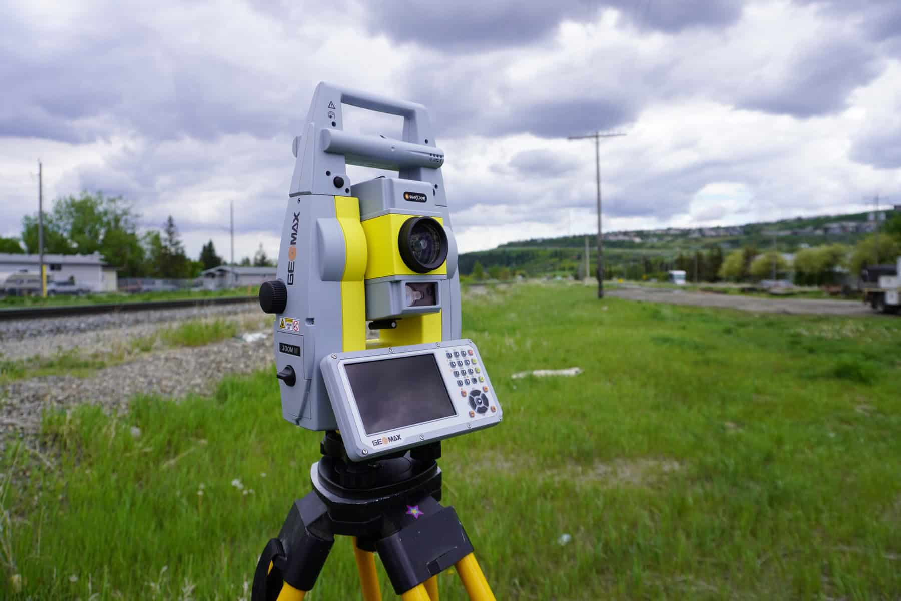
GeoMax produces both manual total stations and robotic total stations, designed for tasks such as construction layout, topographic surveys, and precise engineering measurements.
GeoMax instruments are widely used in land surveying, construction, infrastructure development, engineering, and GIS data collection where precise positioning and measurement are required.
Yes. GeoMax systems work with various survey data collection and processing software platforms, including field controllers and mobile applications used for GNSS and total station workflows.
GeoMax X-Pad is field software designed to control surveying instruments, collect measurements, and manage survey data directly from mobile devices or controllers in the field.
Everything you need to know
Selecting the right GeoMax solution depends on your application, accuracy needs, and workflow.
1. Define Your Application
GeoMax Total Station → High-precision layout and measurement
GNSS receivers → Large-area positioning and mapping
GeoMax Lasers → Leveling and alignment for construction
2. Determine Accuracy Requirements
Millimeter-level → Total stations for precise layout
Centimeter-level → GNSS for surveying and mapping
3. Consider Your Workflow
Field-heavy work → Durable GNSS and robotic total stations
Construction-focused → Lasers and layout tools
4. Evaluate Integration Needs
Choose equipment that integrates with your existing data collection and processing workflows.
5. Budget & Scalability
GeoMax offers solutions that scale with your business, allowing you to expand your capabilities over time.

Feature | GeoMax Survey Equipment | Leica Geosystems | Trimble | Topcon |
Measurement Accuracy | ✔ High precision | ✔ Industry-leading | ✔ | ✔ |
Ease of Use | ⭐⭐⭐⭐⭐ (very intuitive) | ⭐⭐⭐⭐ | ⭐⭐⭐⭐ | ⭐⭐⭐⭐ |
Product Range | GNSS, total stations, lasers | GNSS-focused | GNSS-focused | GNSS + construction |
Durability | ✔ Rugged design | ✔ | ✔ | ✔ |
Integration | ✔ Seamless ecosystem | ✔ | ✔ | ✔ |
Price | 💲💲💲 (strong value) | 💲💲💲💲 | 💲💲💲💲 | 💲💲💲 |
Best For | Balanced performance + value | Premium users | Enterprise workflows | Construction focus |
Surveying, construction, engineering, and mapping workflows
Land Surveying
GeoMax Survey Equipment is widely used for boundary surveys, topographic mapping, and control point measurements, ensuring consistent accuracy across projects.
Construction & Site Layout
GeoMax Total Station systems and GeoMax Lasers provide precise layout, alignment, and leveling for construction projects of all sizes.
Civil Engineering
Engineers rely on GeoMax tools for infrastructure development, road design, and site planning, where accuracy and reliability are critical.
GIS & Mapping
GeoMax GNSS receivers support efficient geospatial data collection for mapping and GIS professionals working across large areas.
Infrastructure & Development
From utilities to large-scale development projects, GeoMax equipment helps maintain precision and efficiency throughout the project lifecycle.
Accurate, durable solutions for professional field work
GeoMax surveying instruments are designed for professionals who require reliable performance, accuracy, and ease of use in the field. The lineup includes total stations, GNSS receivers, digital levels, and data collectors that support a wide range of surveying and construction applications.
These systems are built to handle demanding conditions while helping improve efficiency, reduce errors, and maintain consistent measurement quality across projects. With the right setup, GeoMax equipment supports smooth workflows from field data collection to final results.
What We Offer
This approach ensures your equipment performs consistently and fits seamlessly into your daily workflow.