Home > Depth Sounder

Why buy from Bench Mark?
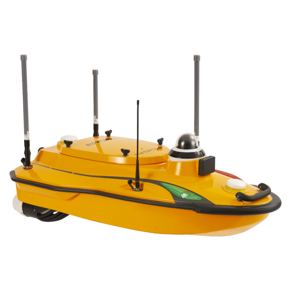
Modern technology has opened up a world of possibilities for GNSS surveying equipment. Each new device promises ways to make your job easier — and they do! The CHCNAV D390 depth sounder is no exception. Offering a modern approach to small-scale hydrographic surveying, this device is essential to every surveyor’s toolbox. Depth sounders allow the modern surveyor to create bathymetric surveys of any body of water, accurately mapping the contours of the lake or seafloor. For an industry that once relied on lead weights and cord, bathymetry, or depth sounding, has come a long way with the introduction of modern depth sounders. They now use a sonar transducer to reflect sound waves off the seafloor, measuring the time it takes the sound pulse to reflect. These devices offer greater accuracy in mapping at a more affordable price.
Showing all 2 results
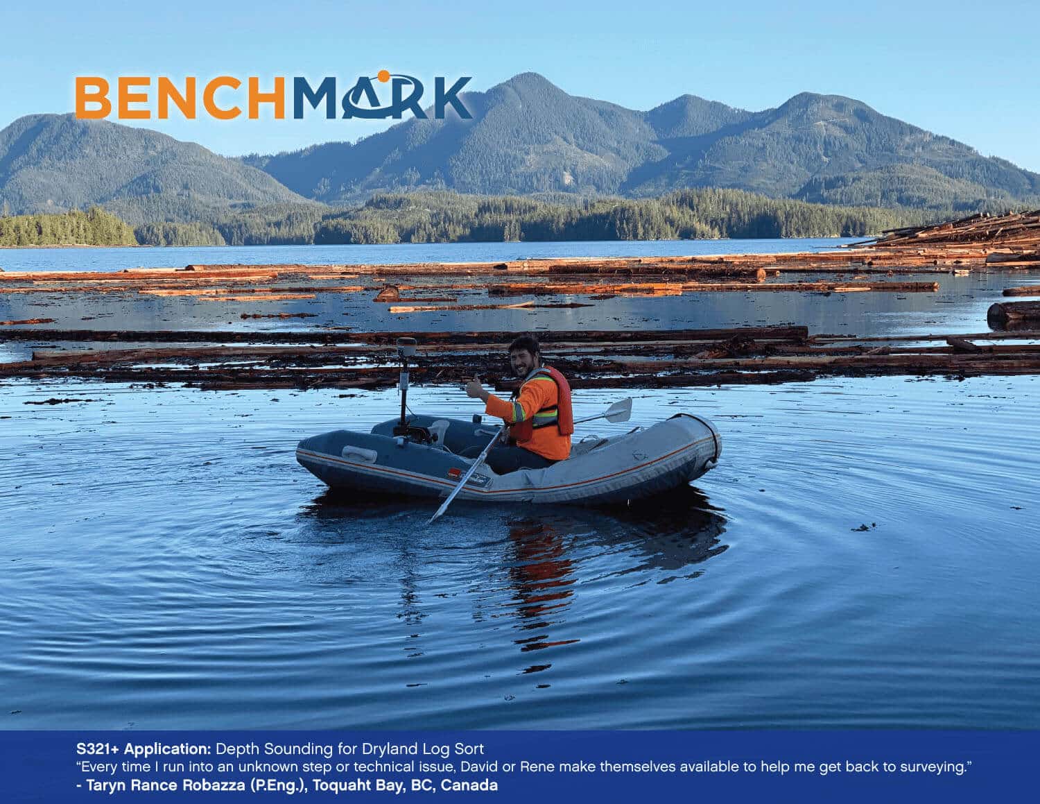
Bathymetry surveys typically use single-beam or multi-beam echo sounders, GNSS receivers, data collectors, and rugged field tablets. These systems work together to measure underwater depth and create accurate bottom profiles for lakes, rivers, harbors, and coastal projects.
Modern bathymetry systems can achieve accuracy within a few centimeters when paired with an RTK GNSS receiver and properly calibrated sensors. Accuracy depends on water conditions, vessel stability, and the type of depth sounder used.
Most bathymetry systems use acoustic sonar to measure the time it takes for a sound pulse to travel to the bottom and back. When combined with GNSS positioning and motion compensation, this allows you to generate precise depth measurements and contour maps.
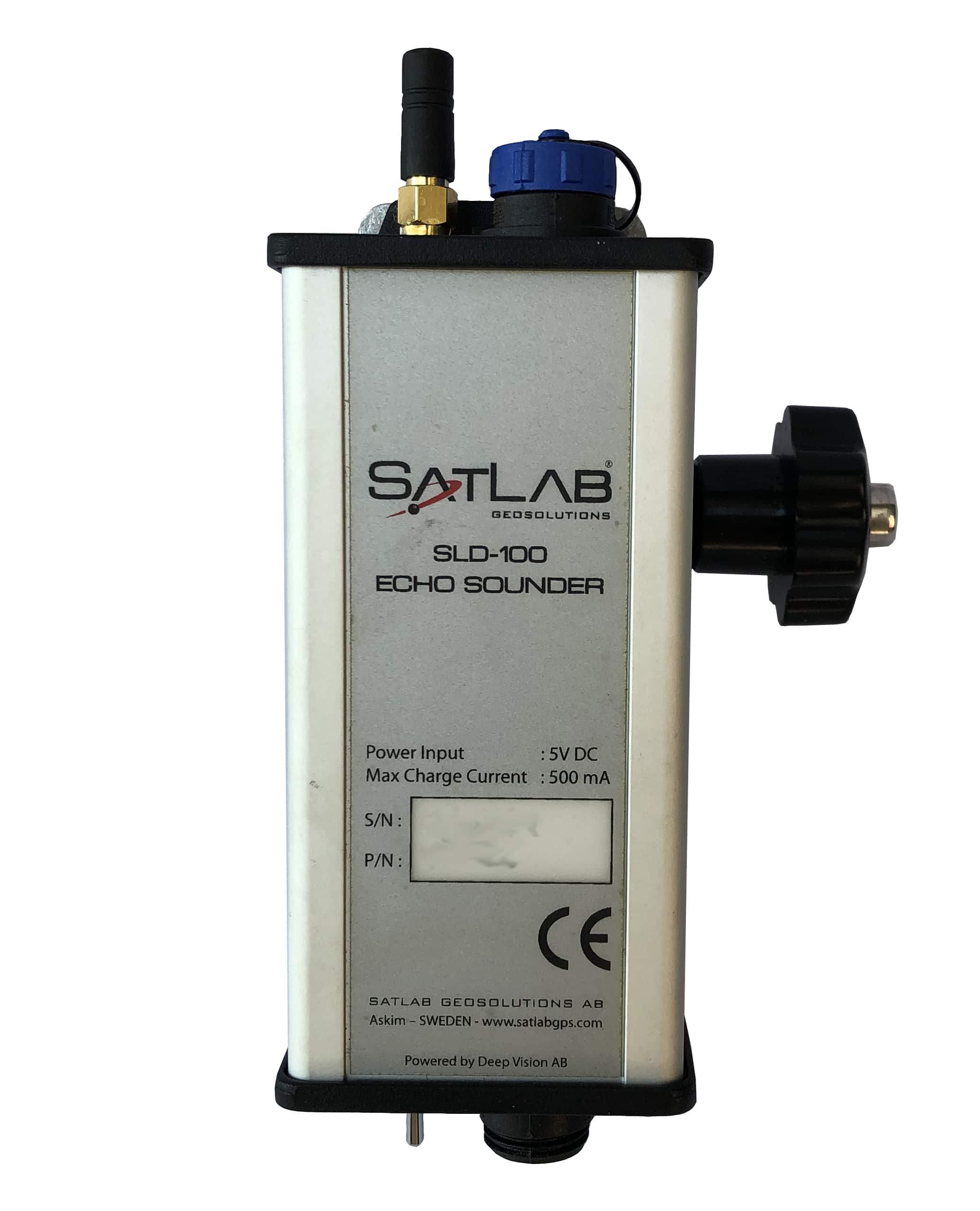
A depth sounder is an acoustic instrument that measures water depth by sending sound pulses downward. They’re ideal for rivers, lakes, reservoirs, and near-shore environments where accurate single-beam measurements are required.
A depth sounder is a type of sonar. Both use acoustic pulses to measure distance, but a depth sounder focuses specifically on vertical depth measurement, while broader sonar systems can map objects or scan side-to-side.
Depth capability depends on the sounder model and water conditions. Many single-beam systems can measure from shallow water (less than one foot) to several hundred feet. We can help you choose the right unit based on your required depth range.
Bathymetry can be affected by waves, vegetation, turbidity, sediment layers, and vessel movement. Using RTK positioning, stable mounting, and proper calibration helps minimize these limitations and improve data quality.
Pricing varies depending on whether you need a single-beam sounder, GNSS receiver, mounting hardware, or a complete turnkey boat kit. Entry-level systems are affordable, while advanced packages with RTK and motion sensors cost more. We can build a solution that fits your project and budget.
Bathymetric survey equipment price depends on the type of depth sounder used, GNSS integration, sensor accuracy, and whether additional components such as motion sensors or mounting hardware are required. Project depth, accuracy requirements, and operating environment also influence overall system cost.
What you need to know about Bathymetry
Bathymetry is required in many waterways, both for construction and ensuring easy navigation. Used in conjunction with a GNSS RTK receiver providing accurate 3-dimensional positioning, an echo sounder like the CHCNAV D390 will generate a precise map of subsurface conditions. Whether you are trying to dredge a channel, locate pilings for a bridge, or map the contours of a lake, the CHC depth sounder is the perfect tool. Modern echo sounders are designed for easy integration with RTK GPS and other surveying equipment. The sounder outputs data strings which are input into various hydrographic software, including the HydroSurvey7 software, to build accurate 3D maps and contour models. This integration of technology allows a surveyor to enter a marketplace that was traditionally dominated by dedicated and expensive mapping sonar.

We Carry the Best Tools & Equipment
As one of the best depth sounders in the USA, the CHCNAV D390 is a user-friendly device that uses sonar waves to accurately identify, within 1 cm, depths from 15cm to 300m deep. The ping frequency of the sonar transducer is 200kHz, ensuring accurate data resolution for all depths. The narrow transducer beam also works to ensure that you have the highest resolution depth data. Mounting the D390 depth sounder is extremely simple in conjunction with your GPS RTK receiver. We carry this top-of-the-line device at Bench Mark for your convenience. If you have questions about how it works, or you’re interested in other equipment like a robotic total station, give us a call! We are committed to providing exceptional customer care and ongoing service.