


The Global Positioning System that launched as a military tool in the 1970s wasn’t designed with land surveyors in mind. For years after it became available to civilians, standalone GPS delivered accuracy measured in meters, useful for navigation, useless for boundary work. What changed everything wasn’t the satellites themselves, but the correction techniques and receiver technology built on top of them.
Today, a properly configured GNSS RTK system can place you within a centimeter of truth, anywhere in the continental U.S., often within seconds of setup. But that performance gap between what’s possible and what most crews actually achieve in the field comes down almost entirely to equipment selection, and understanding what you’re actually buying.
GPS, GNSS, and RTK: Getting the Terminology Straight
How to Use GPS in Land Surveying: Understanding Your Correction Options
Choosing the Right System for Your Survey Work
Field Practices That Protect Your Accuracy
The Equipment Decision Is a Long-Term One
When land surveyors say “GPS,” they almost always mean something more sophisticated than the acronym implies. Here’s why the distinction matters when you’re specifying equipment for U.S. projects.
GPS refers specifically to the American satellite constellation, 31 operational satellites maintained by the U.S. Space Force. On its own, standalone GPS delivers 2–5 meter accuracy under ideal conditions. That’s adequate for navigation but disqualifying for survey-grade work.
GNSS (Global Navigation Satellite System) is the correct term for receivers that track multiple constellations simultaneously, GPS, Russia’s GLONASS, Europe’s Galileo, and China’s BeiDou. A full multi-constellation receiver can access 40 or more satellites at any given moment. More satellites mean better geometry, faster initialization, and more resilience when part of the sky is blocked by trees, terrain, or structures.
RTK (Real-Time Kinematic) is the correction technique layered on top of GNSS that gets you to centimeter accuracy. A base station, either one you deploy or a network reference station, broadcasts real-time corrections to your rover, allowing it to resolve carrier-phase measurements and output positions accurate to 1–2 cm horizontally and 2–3 cm vertically while you’re actively moving through a site.
When a supplier markets a product as “GPS equipment for land surveyors,” the minimum acceptable specification is a multi-constellation GNSS receiver with RTK capability. Single-constellation, single-frequency units simply don’t meet the tolerance requirements for boundary surveys, construction layout, or topographic control in 2025.

The correction source you connect to is as important as the receiver itself. U.S. surveyors generally work with one of three setups.
You set a receiver over a known control point, a monument with published NGS coordinates, or a point you’ve established via static observation, and configure it to broadcast corrections over UHF radio or cellular. The rover in the field receives those corrections and achieves centimeter accuracy relative to the base. This approach gives you maximum control, works without cellular coverage, and allows you to establish local accuracy independent of any network. The tradeoff is the time to set up and the requirement for a second receiver.

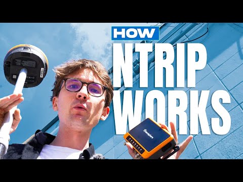
The National Geodetic Survey operates a network of Continuously Operating Reference Stations (CORS) across the U.S., and many states maintain additional networks. By connecting your rover to an NTRIP caster over cellular, you eliminate the need for your own base entirely, one person, one rover, centimeter accuracy. Coverage in rural and frontier areas is the limiting factor; check network density in your region before relying on this method exclusively.
Commercial VRS services interpolate between multiple reference stations to generate a correction stream as if a base were located near your rover. This improves accuracy over long baselines compared to using a single distant CORS station. Several commercial providers offer statewide or regional VRS coverage in the U.S. on a subscription basis.
For most U.S. survey work, network RTK is the most efficient workflow where cellular coverage exists. For remote projects, rural boundary work, mining sites, large-scale topographic surveys in mountainous terrain, a base-rover pair remains the more reliable choice.
The right equipment depends on what you’re actually surveying. These are the primary use cases and what they demand from your gear:
Boundary and control surveys require the highest accuracy and traceability. You need multi-frequency GNSS, reliable initialization, and the ability to connect to NGS datums. Equipment like the Hemisphere S631 is well-suited here, it delivers the phase measurement stability these surveys demand, and because Bench-Mark provides direct support, you’re not chasing down a manufacturer support line when something needs resolving in the field.
Construction layout and stakeout puts a premium on speed and durability. Crews move fast, equipment gets dropped, and the workday runs longer than specs suggest. Prioritize IP67 or better housing, hot-swappable batteries, and fast re-initialization after signal loss. Tilt compensation is a practical advantage here, it eliminates the time spent leveling the pole on every shot.
Topographic and GIS-grade surveys where absolute accuracy requirements are relaxed can be served by lighter, lower-cost receivers. The GeoMeasure Nano 7 fills this space, a capable multi-constellation receiver at a price point that makes sense when the project tolerance doesn’t require the top tier of performance.
Engineering and monitoring applications, rail, environmental, infrastructure inspection, often require logging capability, integration with sensors beyond GNSS, and the ability to operate unattended. Geodetic-grade receivers with flexible output formats are the right call here.
The best receiver on the market still depends on how it’s deployed. These practices separate surveys that hold up under scrutiny from those that don’t:
Choosing GPS equipment for land surveying isn’t just about what works on the next project, it’s about what holds up across seasons, supports the workflows you build around it, and comes with a supplier who can help you troubleshoot it when the field doesn’t cooperate. Specs matter, but so does the relationship behind the equipment.
At Bench-Mark, we operate differently from most equipment suppliers, no regional franchise to navigate, no territory lock, just direct access to the right equipment and the people who know how to support it across the U.S. If you’re evaluating GNSS RTK systems for your survey operation, talk to us about what you’re actually trying to accomplish. The right system is the one that keeps your crew productive on the hardest days, not just the easy ones.
