Home > GIS Systems
Why trust Bench Mark
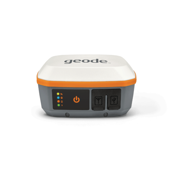
GPS and GNSS Mapping equipment or precise GIS data collection devices are important tools in a variety of trades sectors. GIS & GPS mapping equipment is typically less expensive and easier to use than traditional RTK land survey equipment. Useful to industries such as gas, cable, pipeline, electric, and phone utility companies, DGPS mapping equipment allows you to build an accurate map of your assets in a fraction of the time compared to traditional survey tools. The fast and precise location of assets gives crews an advantage when it comes to troubleshooting and verifying the status of right of way and pipeline routes. GIS, or Geographic Information System, refers to the collection and analysis of this data, and is facilitated by GPS mapping tools, and dedicated mapping software. At Bench Mark, we sell the Juniper Systems Geode GPS receiver, designed for integration into your existing mapping infrastructure. We are proud to offer top-quality equipment and dedicated customer service to our customers.
Showing all 6 results
A Geographic Information System (GIS) is a framework for gathering, managing, and analyzing data. It integrates many types of data and uses spatial location to analyze patterns and trends. GIS reveals deeper insights into data, such as relationships, patterns, or situations—helping users to make smarter decisions.
While both GIS and GPS deal with geographic information, they serve different purposes. GPS, or Global Positioning System, is a technology that provides real-time location data using satellites. It is often used for navigation and mapping. On the other hand, GIS is a system for organizing, analyzing, and visualizing geographic data and associated information. GPS can be a data input method for a GIS, providing the spatial data that the GIS can then analyze.
GIS Systems are relatively easy to use, especially when compared to full grade survey GNSS technology. Here at Bench-Mark we offer a full training and support site to help you get up and running. Often times, it takes as little as five minutes to get up and running, even with no previous experience.
All of our GIS systems are fully compatible with all major GIS software packages. This includes FieldGenius, ArcGIS, Uinta, Survey123 and more. As long as the software is compatible able to receive an NMEA string over Bluetooth, it can work with our receivers.
Dedicated to outstanding quality
We offer the next generation of GNSS RTK and surveying GPS devices, including the Hemisphere S321+ as part of our selection. Our modern RTK GPS systems are built to last, providing surveyors with ample opportunity to use them on various landscapes and in different scenarios. Designed to be efficient, accurate, affordable, and to maximize performance standards and results, our products have several state-of-the-art features and capabilities. Customizable and programmable to perform a wide range of functions from hydrographic work to crash site forensic reporting, the potential of these devices is endless. With our experience and knowledge of handling such products, we can ensure our customers receive the best systems for their needs.

Trust Bench Mark with your projects
As a provider of surveying equipment to over 200 clients across North America, we have established ourselves as the USA’s leading supplier. For anything GNSS related, from land surveying to GIS to vehicle positioning, our knowledge and support allow us to provide our clients with exactly the right product for their needs. Upon purchase, we continue to offer support by providing prompt and superior troubleshooting and technical service, ensuring our products are working as they should. If you’re looking for new and used surveying equipment at great prices, reach out to Bench Mark.
North America’s #1 supplier of land surveying equipment and instruments.