
Theodolites, total stations, and GNSS receivers each have their place in modern surveying. But knowing when to reach for which tool isn’t always obvious. Read further to discover how these instruments compare, and help you decide which equipment fits your specific workflow and project requirements.
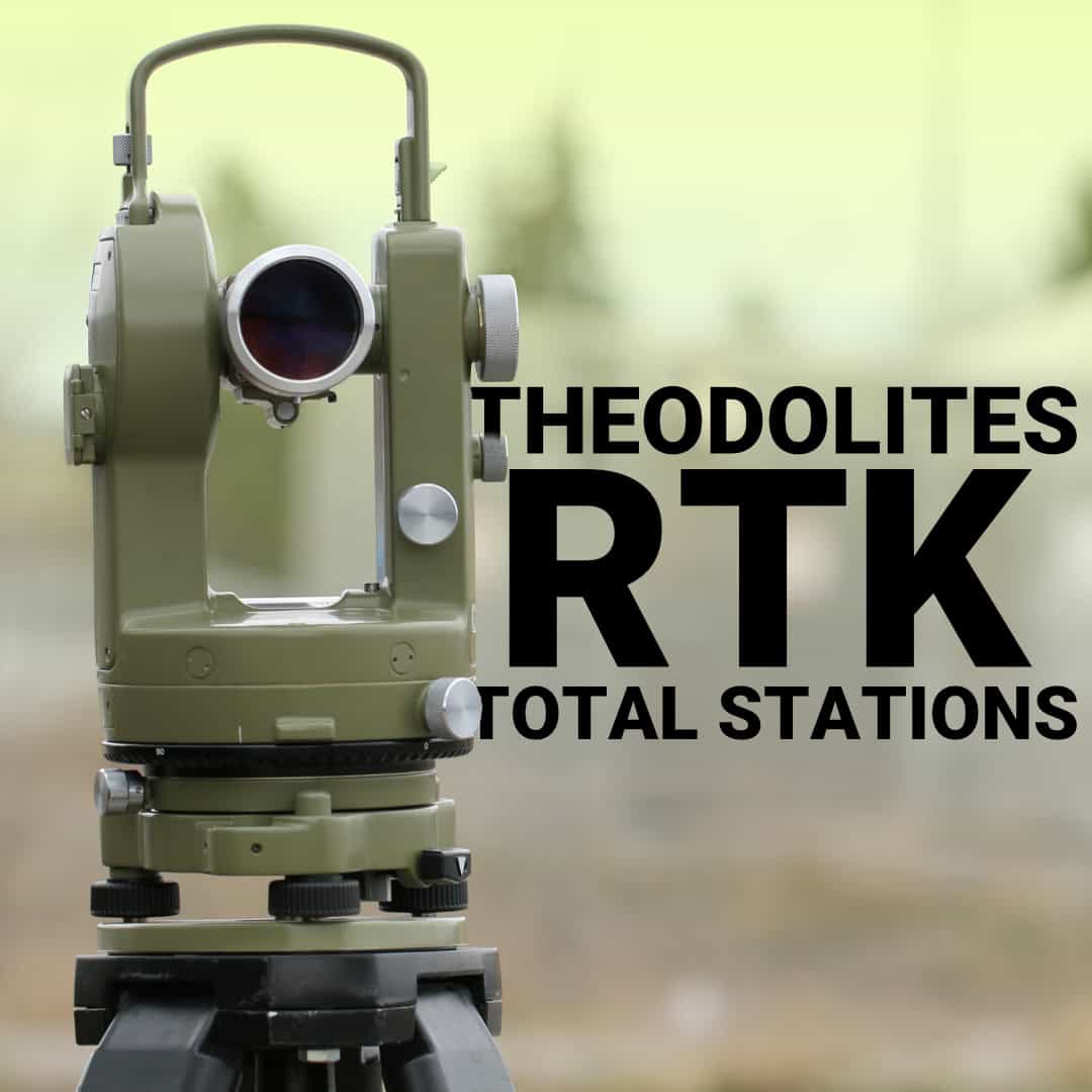
What is a Theodolite Surveying Instrument
Total Stations: The All-in-One Solution
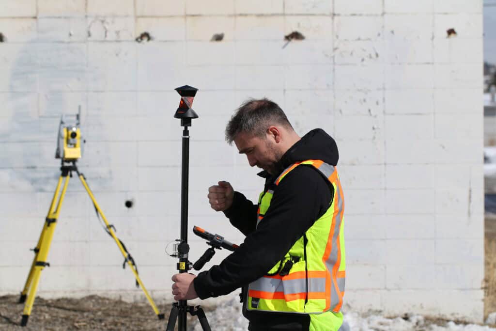
GNSS RTK: Satellite-Based Positioning
When to Use Each Instrument Type
Accuracy Considerations
Making the Right Choice
A theodolite is a precision optical instrument designed specifically for measuring horizontal and vertical angles. It consists of a telescope mounted on two perpendicular axes, allowing it to rotate both horizontally and vertically while maintaining accurate angle measurements. Surveyors have relied on theodolites for centuries because they deliver consistent, reliable angular measurements without the complexity or cost of more advanced systems.
The theodolite surveying instrument works through direct observation. You set up the instrument over a known point, sight through the telescope to your target, and read the angle from calibrated circles.
Modern survey theodolites include features like laser plummets for quick setup over points, illuminated reticles for low-light conditions, and electronic displays that improve reading accuracy. Some models achieve accuracy levels of five seconds of arc or better, putting them on par with entry-level total stations for angular precision.
The key difference is that theodolites measure only angles, requiring separate distance measurements through taping, EDM add-ons, or calculation from known coordinates.
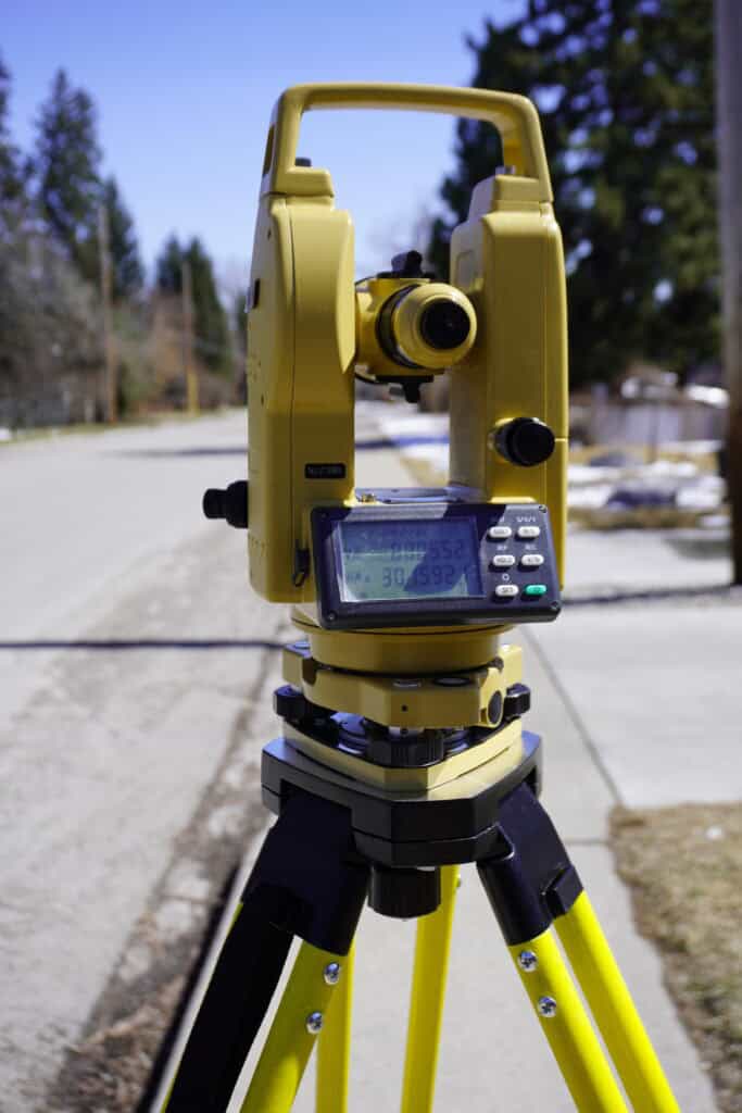
Total stations evolved from theodolites by integrating an electronic distance meter directly into the instrument. This combination allows simultaneous measurement of both angles and distances, fundamentally changing how surveyors work in the field. Instead of measuring an angle with a theodolite and then running a tape or separate EDM to get distance, a total station captures everything in one shot.
The built-in computer in a total station processes measurements in real time, calculating coordinates, elevations, and horizontal distances automatically. Modern total stations running software like FieldGenius can import design files, navigate to layout points, and store thousands of measurements without manual data recording. This integration eliminates transcription errors and dramatically speeds up fieldwork and office processing.
Total stations come in several configurations.
For construction layout, topographic surveys, and boundary work where both angles and distances matter, total stations deliver efficiency that theodolites can’t match.
The ability to stake points directly from design coordinates, verify as-built conditions against plans, and collect detailed topographic data all happen faster and more accurately with a total station than with separate instruments.
GNSS RTK systems like the Hemisphere S631 represent a completely different approach to surveying. Instead of measuring angles and distances to visible targets, GNSS receivers determine position by processing signals from satellite constellations orbiting overhead. Real-time kinematic positioning uses corrections transmitted from a base station to achieve centimeter-level accuracy at the rover receiver.
The major advantage of GNSS RTK is speed and flexibility across large areas. Once you establish a base station, the rover can occupy any point within radio range and get coordinates within seconds.
For subdivision layout, large construction sites, topographic mapping, or any project covering significant acreage, GNSS RTK dramatically outperforms optical instruments in terms of productivity.
However, GNSS requires clear sky visibility to track satellites. Dense tree canopy, tall buildings, underground locations, and any environment where satellite signals can’t reach the antenna will prevent GNSS from working. Multipath errors from reflected signals can also degrade accuracy near reflective surfaces or in urban canyons between buildings. This is where optical instruments maintain their advantage.
The choice between theodolite surveying instruments, total stations, and GNSS depends on your project conditions, accuracy requirements, and budget. Here’s how to match the right tool to your situation.
All three instrument types can deliver the accuracy needed for professional surveying, but they achieve it differently. Theodolites measuring only angles typically achieve accuracy between 5 to 20 seconds of arc depending on the model. For traverse work or control networks, this angular precision combined with careful distance measurement produces reliable coordinates.
Total stations match or exceed theodolite angular accuracy while adding distance measurement precision of 2-3mm plus a few parts per million of the measured distance. This combination allows coordinate determination with millimeter-level consistency when working at typical survey distances. The integrated measurement and onboard computing reduce errors from manual recording and calculation.
GNSS RTK systems achieve horizontal accuracy of 10-20mm and vertical accuracy of 20-30mm under good conditions. For most construction and land development work, GNSS RTK accuracy is more than adequate.
Most professional survey operations eventually need more than one instrument type. The surveyor who relies exclusively on GNSS will struggle in heavily wooded areas or urban environments with limited sky visibility. The crew using only total stations will find large-scale projects take far longer than necessary. Our Bench-Mark team can help you make the choice that fits your workflow and budget. Having the right tool for each situation, or knowing when to rent specialized equipment, keeps your operation flexible and efficient.
