

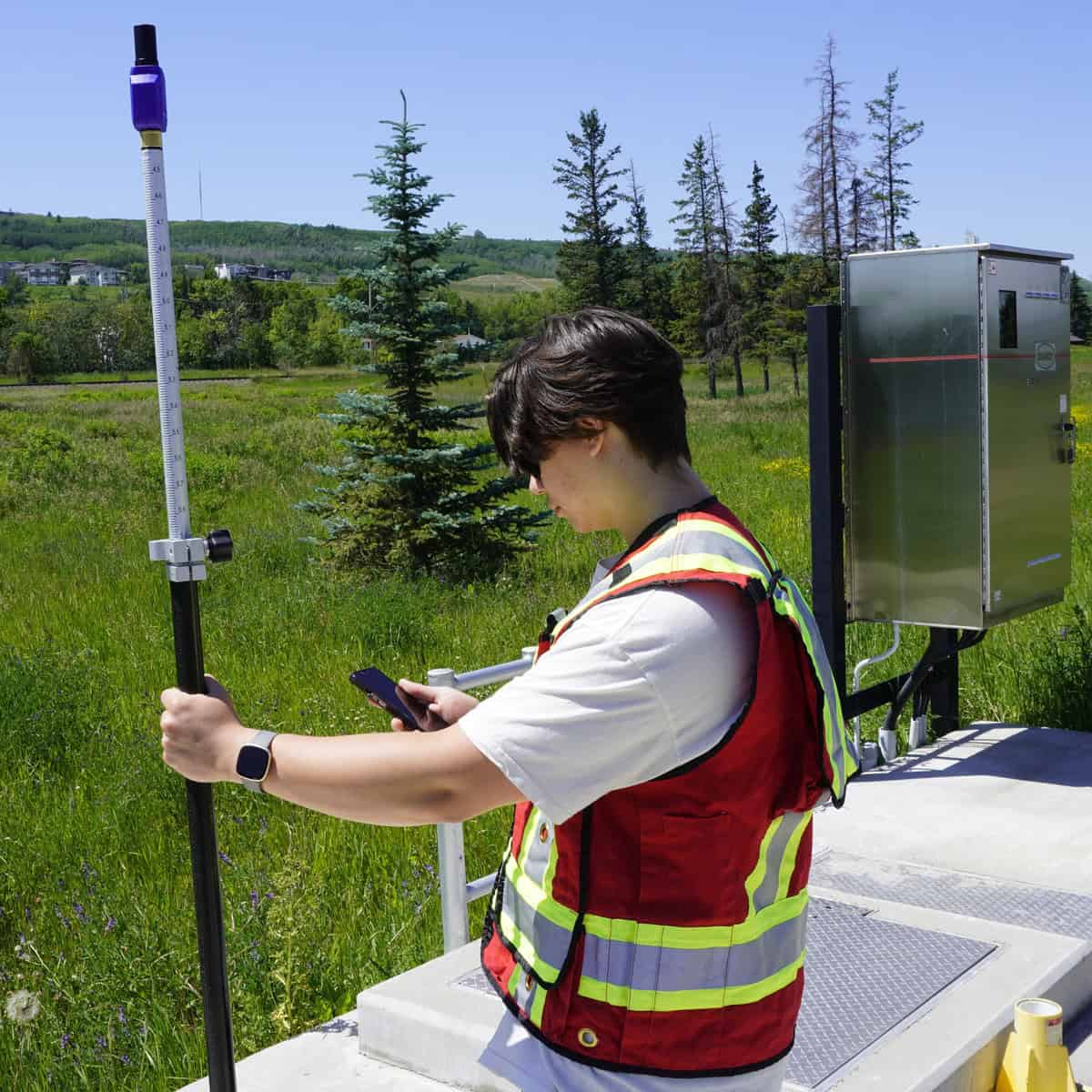
The PinPoint is the latest portable multi-functional GNSS receiver, from GeoMeasure which supports, network and DGPS measurements. It is extremely light-weight, packaging high-end mapping precision in a compact hardened plastic structure. Compatible with MicroSurvey’s FieldGenius, ESRI and Uinta, this is a fully functional GIS antenna perfect for advanced measurements.
https://youtu.be/–IYJ4wrLdA



"*" indicates required fields
Product details
Package includes
The GeoMeasure PinPoint is a lightweight GNSS receiver designed for GIS mapping, utility asset collection, environmental surveys, and other field data collection tasks. Its compact design makes it useful for crews that need accurate location data without carrying a larger survey-grade receiver.
The PinPoint supports sub-meter autonomous positioning. Its product brochure specifies standalone accuracy of 30 cm horizontally and 60 cm vertically. Actual results can vary with satellite visibility, obstructions, multipath interference, and other field conditions.
Yes. The PinPoint supports RTK corrections, with manufacturer-listed single-baseline accuracy of 8 mm + 1 ppm horizontally and 15 mm + 1 ppm vertically. Achieving this performance requires suitable RTK corrections, a compatible field setup, and favorable satellite and measurement conditions.
The receiver tracks GPS, GLONASS, BeiDou, Galileo, QZSS, and SBAS signals. Its multi-constellation, multi-frequency design helps it use signals from multiple satellite systems to determine position. Actual satellite availability depends on the location and current signal conditions.
Yes. The PinPoint supports network RTK workflows and NTRIP connectivity. Receiving corrections requires access to a compatible correction service and a working communications connection; service subscriptions and mobile data charges may apply depending on the setup.
The PinPoint is listed as compatible with MicroSurvey FieldGenius, ESRI software, and Uinta. FieldGenius also lists the PinPoint among its supported GNSS receivers. Verify compatibility with your specific software version and data collector before purchasing, especially if your workflow depends on a particular mobile operating system.
The PinPoint has a built-in 1,800 mAh lithium-ion battery rated for more than nine hours of operation. Charging takes less than five hours according to the product brochure. Actual runtime can vary with operating conditions and how the receiver is used.
Yes. The receiver has an IP67 ingress protection rating and a specified operating temperature range of -20°C to +60°C (-4°F to 140°F). Its compact housing is designed for field use, although the receiver should still be handled and maintained within the manufacturer’s environmental guidelines.
The listed package includes the PinPoint receiver and a charging cable. A data collector with FieldGenius and accessory kits can be selected through the quote form, but these are configurable options rather than items that should be assumed included with every purchase.


Cristian Moldovan –
I had a pleasant professional experience with Bench Mark team, from the first contact to shipping of the equipment.
I recommend it.
Jen Hennessy –
Great experience working with Benchmark on the GNSS PinPoint. Even though it’s a relatively small mapping-grade GNSS unit compared to their typical equipment, the level of service was excellent. David took the time to call, answer all my questions over a couple of weeks, and made sure I was choosing the right setup for our needs. Really appreciated the responsiveness and support throughout the process.
Ed van Vliet –
The entire process from inquiry to purchasing was quick and painless.