

Surveyors need to use high-tech land surveying equipment to create maps, measure distances and specific areas to ensure they can complete their tasks at hand.
Underestimating the importance of these projects should not occur. Surveyors must stand by their work, as their results determine the future outcome of many projects. To provide accurate calculations requires the right equipment.
However, while each job might be different, there are few consistent equipment pieces that are always in use.
The main pieces of surveying equipment in use for professionals around the United States include the following:
While these are the most common land surveying equipment, it is important to note that they will be adapted, depending on the task at hand. Understanding what equipment do surveyors use is therefore important.
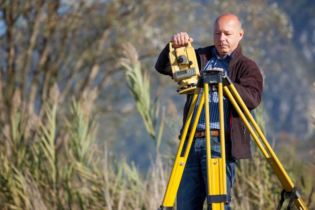
Surveying equipment is only as valuable as how it is applied. Each tool serves a specific purpose, and surveyors rely on them strategically to deliver accurate, actionable results.
For example, RTK systems and GNSS receivers allow surveyors to pinpoint positions with centimeter-level accuracy. That’s why they are indispensable for large-scale land mapping and construction layouts. Robotic total stations enable a single operator to capture complex angles and distances quickly.
EDM instruments and theodolites provide reliable angle and distance readings and support both boundary marking and topographic surveys. Optical levels ensure accurate elevation measurements for grading and construction.
Even traditional tools, such as compasses, clinometers, and magnetic locators, continue to provide value in situations where modern technology might be impractical like navigating remote terrain or locating hidden metallic features. Surveying prisms act as critical targets for total stations. They link measurements across distances with minimal error.
This practical application of equipment ensures that every survey can be completed safely, efficiently, and with confidence.
Surveyors are a part of a range of projects, including construction and engineering, geodetic tasks (which revolves around creating maps of substantial land portions) and mapping of both boundary and land locations. Listed below are some of the most common projects for surveyors:
Location & Boundary Survey
A boundary survey locates the corners and boundary lines of a parcel of land. The surveyor will have to provide measurements to determine exact distances and spaces.
Construction Survey
Strengthening the development plan relies on surveyors for many construction projects, For the surveying phase, that includes measuring the structures located on the property, including walls, buildings, roads, and utilities. Horizontal and vertical grading may also be required.
Topographic Survey
A topographic survey locates both natural and man-made features on a parcel of land. This can include a wide range, such as utilities, buildings, elevations, streams, trees, and contours. In most cases, state engineers request topographic surveys for planning site improvements and developments.
Site Planning Survey
While similar to construction surveys, especially in the development phase, a site planning survey combines the elements of boundary and topographic surveys. This process helps aid and plan for design developments before construction begins. It can be used for designing houses, subdivisions, community outdoor activities and centres, commercial and industrial properties, and streets and highways.
When it comes to land surveying, having the right land surveying equipment is essential. The right tools will ensure speedy and accurate measurements for every project, large or small. To avoid mishaps, make sure that you speak to a professional supplier to determine what equipment do surveyors use in reality and which equipment will help you with your project.
Bench Mark Equipment & Supplies is your team to trust with all your surveying equipment. We have been providing high-quality surveying equipment to land surveyors, engineers, construction, airborne and resources professionals since 2002. This helps establish ourselves as the go-to team in Calgary, Canada, and the USA. Plus, we provide a wide selection of equipment, including global navigation satellite systems, RTK GPS equipment, GNSS receivers, and more. We strive to provide the highest level of customer care and service for everyone. To speak to one of our team today, call us on 403-286-0333 or email us [email protected]
