
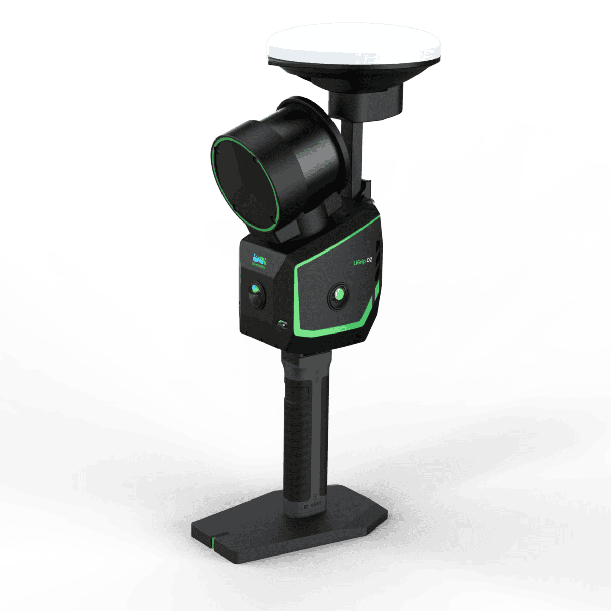
Capture colourized, survey-grade data anywhere with LiGrip O2. Up to 640k pts/s, ranges to 300 m, IP64, and hot-swap power—produce LAS/OSGB/Gaussian Splatting deliverables for topo, as-builts, tunnels, plants, and digital twins without slowing the job.

Product details
Package includes
The LiGrip O2 brings tripod-class accuracy to a handheld workflow, giving construction and engineering teams the certainty they need for progress tracking, QA/QC, and closeout—without slowing the job. A multi-sensor fusion engine blends LiDAR, GNSS, panoramic imaging, and dual VSLAM to lock trajectories and preserve detail as you walk. Expect <3 cm absolute accuracy, <1 cm relative, and <2 cm repeatability that holds up across different operators, paths, and shifts—exactly what you want for slab flatness checks, steel alignment, façade capture, and utility mapping. With 2 mm point spacing, complex edges, rebar, and service penetrations are captured cleanly; real-time colourization aids decision-making on site; and real-time processing cuts rework before you leave the floor.
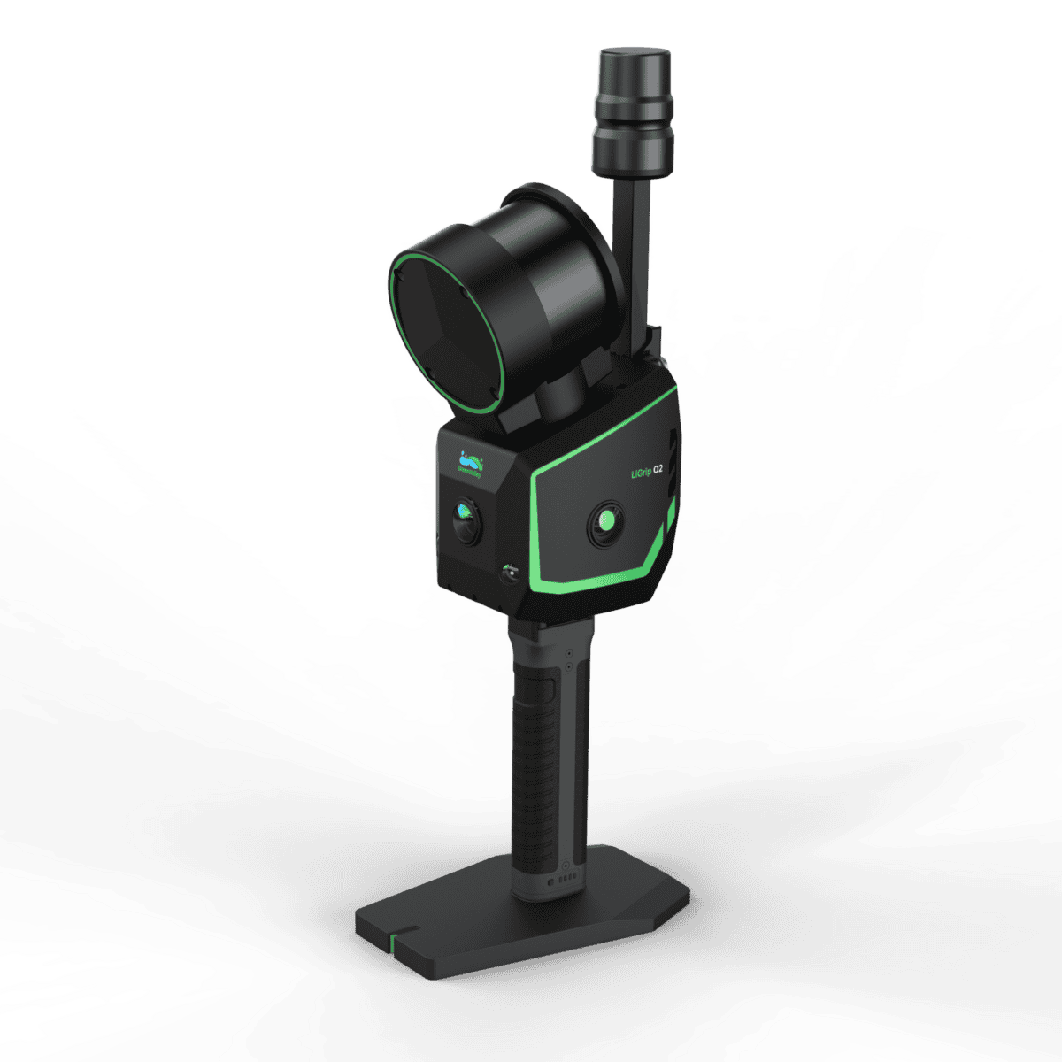
Pick your positioning strategy per environment: RTK-SLAM for instant georeferencing on active sites, PPK-SLAMwhen skyline is poor, MLF-SLAM for low-texture interiors, and SLAM for GNSS-denied plant rooms. Hardware options (XT16/XT32/XT32M2X) scale from 120 m to 300 m range with up to 640k pts/s. The system is IP64-rated, runs -20°C to 40°C, stores to a 512 GB SSD, and weighs about 2.2–2.5 kg—light enough to cover stairwells, scaffolds, and mezzanines without a lift. Power through long routes with ~120 min per battery, hot-swap via the backpack, and deliver client-ready outputs: LAS/LiDATA, OSGB mesh, Gaussian Splatting for photoreal 3D, and panoramic JPGsfor context. If your team builds to tight tolerances and tight schedules, LiGrip O2 is the most practical way to capture reality at survey grade and keep construction moving.
Why builders choose LiGrip O2
Survey-grade SLAM: consistent, repeatable, operator-independent accuracy
Photoreal deliverables: coloured point clouds, OSGB meshes, Gaussian Splatting
Fast coverage: handheld mobility + up to 640k pts/s throughput
Flexible positioning: RTK/PPK/MLF/SLAM—pick what today’s site allows
Jobsite-ready: IP64, Class 1 eye-safe, -20°C to 40°C, hot-swap power


Reviews
There are no reviews yet.