

Electronic Distance Measurement (EDM) has become one of the most important tools in modern surveying. Before EDM, surveying instruments were widely available, and surveyors relied on steel tapes and chains. These are methods that were slow, labor-intensive, and prone to errors from terrain, weather, or even a small misread mark.
Today, EDM surveying technology allows surveyors and engineers to measure distances quickly, accurately, and with far less physical effort. But like every tool, EDM has its strengths and weaknesses. In this guide, we’ll explain how EDM in surveying works, when to use it, and what limitations you need to keep in mind to get reliable results in the field.
What is EDM in Surveying?
How EDM Surveying Instruments Work
Advantages of EDM in Surveying
Limitations of EDM Surveying
EDM vs RTK GNSS: When to Use Each
Best Practices for EDM Surveying
Conclusion: EDM Surveying as a Modern Standard
FAQs
EDM (Electronic Distance Measurement) in surveying is the process of determining the distance between two points using electromagnetic signals. Instead of stretching a tape across rough terrain, surveyors can now send a beam of light (or radio signal) to a target and measure how long it takes to return.
The instrument performs the math, compensates for environmental conditions, and gives you a digital readout of the distance. It’s usually accurate to within millimeters.
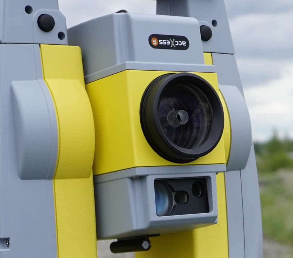
When paired with a total station, EDM surveying instruments can also capture angles, coordinates, and elevation differences, making them a cornerstone of civil engineering, land development, and construction projects across the U.S.
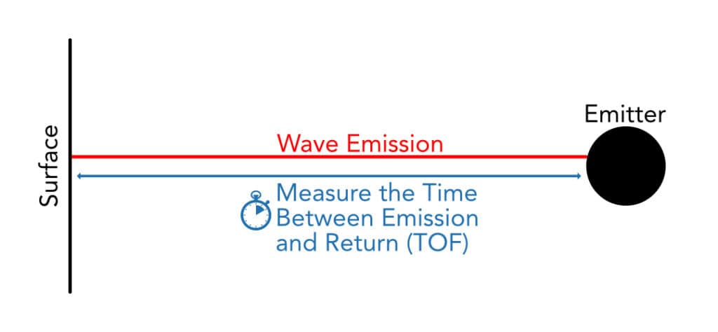
At the core of EDM surveying is a simple principle: measure the time it takes for a signal to travel from the instrument to a reflector and back. Here’s how it works step by step:
Different EDM instruments use different wavelengths:
EDM instruments deliver results down to millimeters over distances of several kilometers. Compared to steel tape, which could easily be thrown off by sag, slope, or temperature changes, EDM provides far greater consistency.
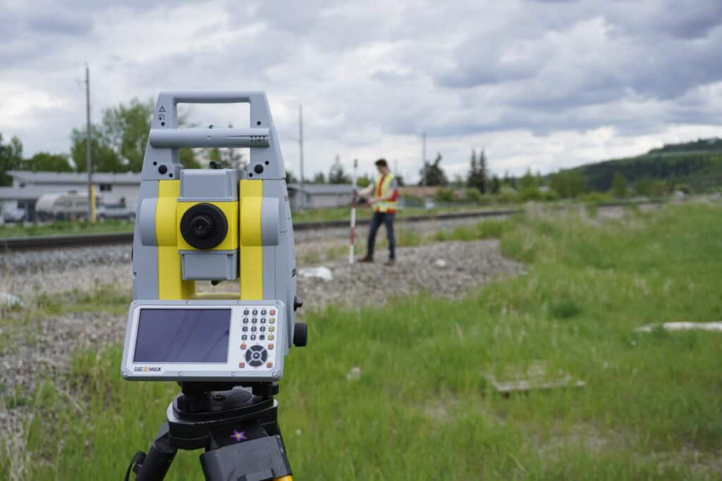
A single surveyor can set up and take measurements that would have required a full crew in the past. This reduces field time and labor costs and allows teams to complete projects faster.
Modern EDM surveying instruments can measure distances up to 100 km under the right conditions. This makes them invaluable for large infrastructure projects like highways, railways, and pipelines.
EDM adapts to a wide variety of industries. Combined with total stations or GNSS, EDM forms the basis of modern geospatial data collection.
Because EDM uses light or electromagnetic signals, surveyors can measure across rivers, valleys, or restricted areas without physically accessing the target. This saves time and improves safety.
Despite its advantages, EDM surveying instruments are not without challenges. Understanding these limitations will help you know when to rely on EDM and when to use other methods like RTK GNSS.
EDM measurements need a clear, unobstructed path between the instrument and the target. Trees, buildings, and terrain features can block signals, limiting use in dense urban or forested environments.
Rain, fog, and snow can scatter or absorb the signal, reducing accuracy or preventing measurements altogether. Heat shimmer and atmospheric refraction can also distort results over long distances.
Nearby power lines, reflective surfaces, or electronic equipment may interfere with EDM signals, especially for infrared and laser instruments.
Reflectorless EDM instruments are convenient, but they often have a shorter range and may struggle with dark, rough, or shiny surfaces. For maximum accuracy over long distances, a prism is still recommended.
EDM instruments need regular calibration to maintain their accuracy. Dust, misalignment, or worn components can introduce errors, so proper care and service schedules are essential.
EDM surveying is often compared to RTK GNSS (Real-Time Kinematic Global Navigation Satellite Systems), another high-precision surveying technology. Both have their place.
In many U.S. projects, surveyors use technologies together. GNSS are used for control networks and large-scale mapping, and EDM for precision layout and detail work.
To get the most from your EDM surveying instrument, follow these field-tested tips:
EDM surveying instruments have completely changed the profession and made distance measurement faster, more reliable, and more versatile than ever before. If you’re laying out a subdivision, checking grades on a construction site, or building a control network for a rail project, EDM provides the precision you need to do the job right.
Still, EDM is not a silver bullet. Its reliance on line of sight and vulnerability to weather means it should be paired with other tools, especially RTK GNSS, for the best results in the field.
At Bench-Mark, we’ve worked with surveyors across the U.S. and Canada who rely on EDM daily. Our team can help you find the right EDM surveying instrument for your workflow, whether you need a total station for precision layout or a GNSS rover for large-scale projects.
EDM stands for Electronic Distance Measurement. It’s a surveying method that uses electromagnetic signals (laser, infrared, or microwave) to calculate the distance between two points.
An EDM instrument is a device, often built into a total station, that measures distance electronically instead of using physical tapes or chains.
Most modern EDM instruments are accurate to within a few millimeters, even over distances of several kilometers.
EDM requires a clear line of sight and can be affected by weather, signal interference, or poor reflector targets. Regular calibration is also necessary to maintain accuracy.
Neither is strictly better; they serve different purposes. EDM is ideal for precise short-range work and construction layout. RTK GNSS excels at large-scale, mobile surveys with clear sky access.
