

A drone can capture a thousand-acre site in a few hours, generate photorealistic 3D models, and produce orthomosaics sharp enough to count fence posts. That visual fidelity is exactly what creates the biggest misconception in modern surveying: that a great-looking dataset is an accurate one. It isn’t, at least not automatically. Drone photogrammetry is a tool, and like every tool in your kit, the result depends entirely on how it’s applied. The gap between a stunning aerial image and a certifiable survey deliverable is filled by control strategy, processing discipline, and honest accuracy reporting, not the drone itself.
What Actually Controls Your Accuracy
GCPs, RTK, and PPK: Knowing When to Use Each
What Accuracy Numbers Actually Mean
QA/QC: Where the Real Work Happens
Checkpoint Placement Is Its Own Discipline
Accuracy Is Earned
Before you ever launch, several variables are already shaping your final numbers.
Your control strategy, whether you use Ground Control Points, RTK, PPK, or a combination, is the single largest factor in how well your model ties to real-world coordinates. Environmental conditions come next: wind blur, harsh shadows, dense canopy, and tall grass can all degrade feature matching in photogrammetric processing or hide the true bare-earth surface. Flight parameters like altitude, overlap, and camera quality determine your Ground Sample Distance (GSD), which sets a ceiling on what accuracy is even theoretically achievable. Finally, equipment calibration matters more than most operators admit, lens distortion and uncorrected GNSS offsets introduce systematic errors that no amount of post-processing will fully undo.
Because these factors shift from site to site, professional surveyors define tolerances in writing before the drone leaves the ground. That documentation protects you and your client equally.
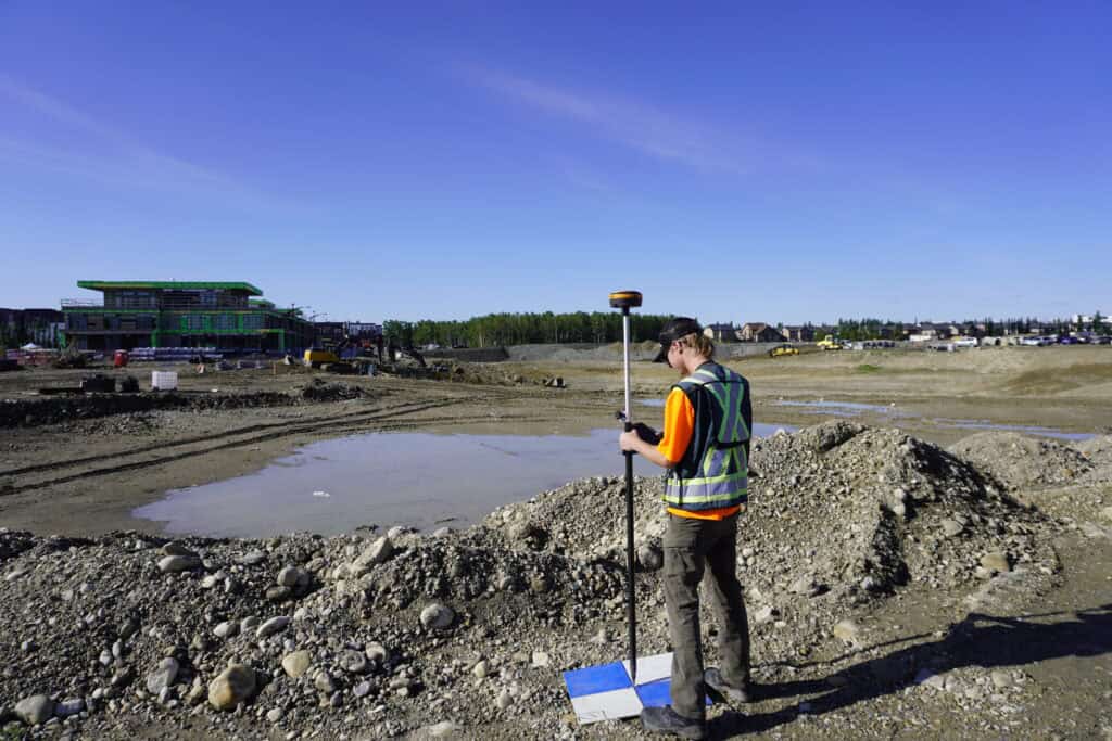
Ground Control Points are physical targets, typically high-contrast markers three to four feet across, placed throughout the site and surveyed with a high-precision GNSS receiver or total station. Photogrammetry software uses their known coordinates to georeference and scale the model. GCPs remain the most reliable method when:
RTK drones apply GNSS corrections in real time from a base station or correction network, recording precise camera positions at the moment of each exposure. PPK takes a different approach, it logs raw GNSS data during the flight and applies corrections afterward in the office. Both systems can dramatically reduce the number of ground control points required on straightforward sites. They tend to shine when the terrain is hazardous, site access is restricted, or turnaround time is tight.
That said, even with a capable RTK or PPK platform, most experienced surveyors still establish independent checkpoints to verify the model. The drone’s onboard system tells you where the camera was. The checkpoints tell you whether the model is right.
The hybrid approach, RTK or PPK drone combined with a reduced set of GCPs or verification checkpoints, is increasingly the practical standard on commercial projects. You get the efficiency of airborne positioning with the confidence of surveyed ground truth.

Typical results from well-executed UAV photogrammetry using GCPs fall within roughly 1–3× the GSD horizontally and 2–4× the GSD vertically. A dataset flown at a one-inch GSD might reasonably achieve one to three inches of horizontal accuracy and two to four inches vertically. Horizontal almost always outperforms vertical in drone work, that’s a characteristic of GNSS geometry, not a flaw in the UAV systems.
Many professional projects in the U.S. report accuracy using the National Standard for Spatial Data Accuracy (NSSDA), which expresses horizontal and vertical accuracy at 95% confidence based on checkpoint testing. A deliverable might read: Horizontal Accuracy 0.10 ft at 95% confidence, Vertical Accuracy 0.18 ft at 95% confidence. That’s the language engineers, GIS professionals, and government agencies understand and expect.
When talking to clients who aren’t surveyors, translate those numbers into something tangible. “Accurate to roughly two inches vertically” lands better than an RMSE figure. Comparing tolerances to everyday objects, the thickness of a few stacked quarters, the width of a marker line, helps set realistic expectations without dumbing down the methodology.
At Bench-Mark, we’d argue that QA/QC is what separates a licensed professional from someone with a drone and a subscription to photogrammetry software. Robust verification procedures follow a consistent pattern:
That processing report isn’t just paperwork. It’s your defense if a client disputes the deliverable months after the project closes.
One of the most common QA/QC catches in the field involves an incorrect antenna height entry at the base station. The model looks clean, but checkpoint comparisons reveal a consistent vertical offset across the dataset. Because the checkpoints were kept out of processing, the error shows up immediately and gets corrected before the client ever sees it. That’s the system working exactly as it should.

The density and distribution of checkpoints matter as much as the number of control points used in processing. Clustering checkpoints near control points produces optimistic results that don’t reflect accuracy across the full project area. Best practice generally means distributing checkpoints throughout the site including the edges, placing them at varying elevations where terrain allows, and ensuring project limits don’t extend more than a few feet beyond the outermost checkpoints. For most projects, three to five well-placed checkpoints tell you far more than a dozen that are all concentrated in the middle of the site.
Drone surveying has genuinely changed what’s possible in the field. Sites that once took days of ground crews can be captured in hours, and the data density is extraordinary. But the technology doesn’t change the fundamentals of what makes a survey deliverable trustworthy. Control strategy, QA/QC discipline, clear documentation, and honest communication with clients are exactly as important as they’ve ever been, the drone just changes how you collect the raw data.
At Bench-Mark, we work with survey professionals across the U.S. who are integrating drone workflows into their practices alongside RTK systems like the Hemisphere S631. The questions we hear most often aren’t about the aircraft, they’re about control strategy, checkpoint density, and how to report accuracy in a way clients and agencies will accept. Those are the right questions, and they’re the ones that determine whether your drone data holds up when it counts.
