
Municipalities depend on accurate and efficient asset mapping to keep cities running smoothly. From fire hydrants and streetlights to water valves and manholes, these assets form the backbone of urban infrastructure. However, one of the key debates in municipal asset management is deciding between sub-meter accuracy and Real-Time Kinematic (RTK)centimeter-level accuracy when mapping these assets. Understanding the differences between these two approaches, their costs, and their applications can help municipalities make an informed decision about the best solution for their needs. Because the gear is so fundamentally different, and the cost can be significantly different, you need to understand the differences before you make a purchase. Check out our video below on the topic.
Sub-Meter Accuracy: Cost-Effective but Limited
Advantages of Sub-Meter Accuracy
Limitations of Sub-Meter Accuracy
RTK Accuracy: Precision for Critical Applications
Key Considerations: Sub-Meter vs. RTK
Real-World Applications of RTK Systems
Municipal assets encompass a wide range of infrastructure elements that are essential for the daily functioning of cities and towns. By ensuring the location of these assets is known we can optimize repair and construction work. Many large cities now provide digital asset maps, you can find examples here: The NYC Map Gallery or City of Oklahoma Interactive GIS Map. Examples include:
These assets need to be accurately mapped and managed to ensure their availability, functionality, and maintenance. The choice between sub-meter and RTK accuracy plays a crucial role in the success of asset mapping projects.
Sub-meter accuracy refers to mapping technologies that can pinpoint asset locations within approximately 0.5 – 1 meter of their actual position. Devices in this category are relatively affordable, with costs ranging from $3,000 to $5,000. Sub-meter equipment is commonly used for mapping non-critical assets where ultra-precise accuracy is not essential. It is perfect for applications where you object is isolated and easy visible from a distance. There are a variety of different options including:
1. Lower Cost: Sub-meter devices are more budget-friendly, making them an attractive choice for municipalities with limited resources.
2. Ease of Use: These systems are simpler to operate and require less training. The software required to run these devices is very often easy to use, with the user simply connecting their receiver to the data collector and immediately being able to begin collecting data. Examples include Juniper’s Uinta and Esri ArcGIS.
3. Adequate for Non-Critical Assets: For features like signposts or benches, sub-meter accuracy provides sufficient detail. When the assets are large and spaced apart this is a perfect solution.
1. Limited Precision: Sub-meter mapping may not be suitable for critical infrastructure like underground utilities. For small or buried objects that you cannot see, this error can lead to you being unable to quickly find what you are locating. Check out this video where I compared a basic phone GNSS solution to RTK to locate a sprinkler head.
2. Integration Challenges: Data collected with sub-meter accuracy may not align seamlessly with other GIS datasets. You can find countless examples of homeowners being confused, as the GIS maps, they are looking at do not line up with their property reports, like this famous video:
3. Potential for Redundancy: If higher accuracy is required later, sub-meter mapping may need to be redone, increasing labor costs over time and negating the initial cost savings.
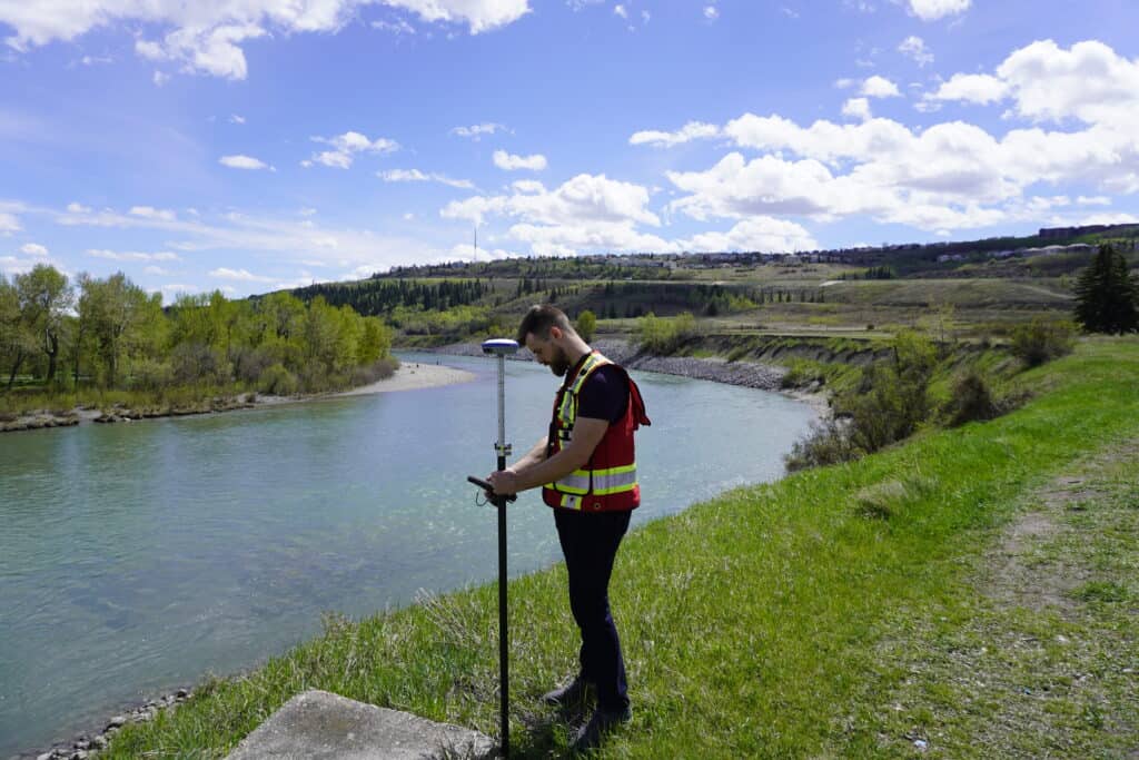
Real-Time Kinematic (RTK) systems provide centimeter-level accuracy, making them the gold standard for high-precision mapping projects. RTK equipment typically costs between $8,000 and $12,000, with additional expenses for correction services such as:
RTK mapping is ideal for situations where precision is critical, such as:
1. High Precision: RTK delivers centimeter-level accuracy, ensuring exact asset locations.
2. Long-Term Savings: By mapping assets accurately the first time, municipalities avoid the labor cost of redoing surveys.
3. Data Integration: RTK data aligns seamlessly with other high-accuracy GIS datasets and local survey plans.
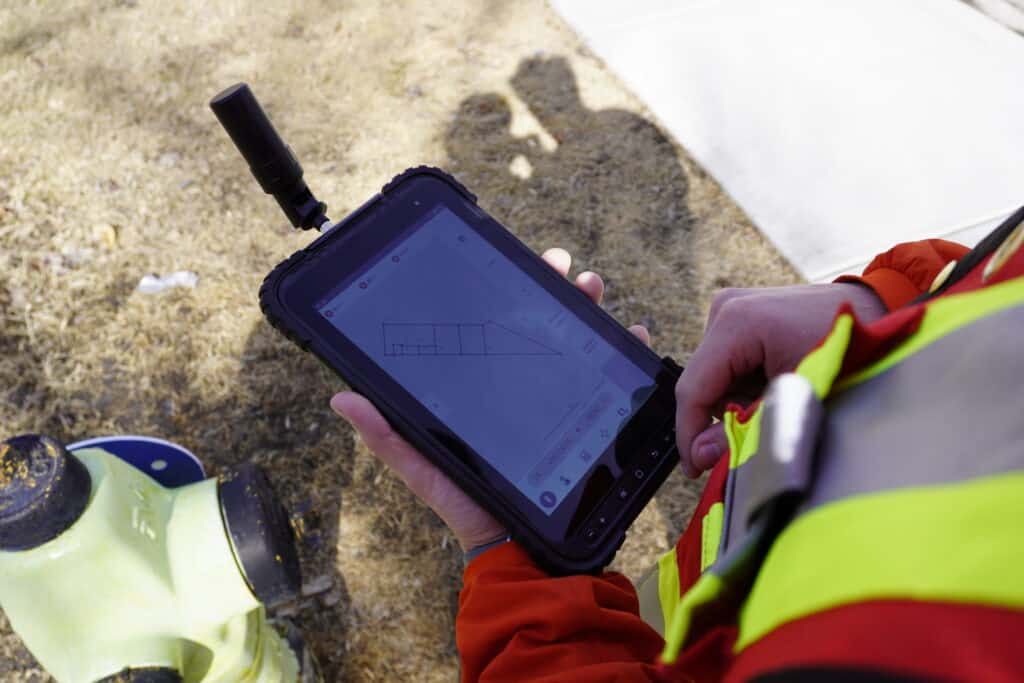
4. Detailed Asset Attributes: Modern RTK systems allow users to record detailed metadata, such as the condition of assets or specific attributes like pipe size and maintenance history. With software like MicroSurvey’s FieldGenius you can associate pictures, notes and attributes with points.
1. Higher Initial Cost: RTK systems are more expensive upfront compared to sub-meter devices, but the reduced labour cost of having to update maps to a higher accuracy later on may offer significant cost savings.
2. Complexity: These systems require more training and technical expertise. However, here at Bench-Mark we have our Survey-Assistant training library that can take someone who has never used RTK equipment to an advanced user in ~55 minutes.
When deciding between sub-meter and RTK accuracy, municipalities should consider several factors:
1. Nature of the Assets
2. Project Scope
3. BudgetWhile sub-meter systems have a lower initial cost, the potential need to redo work can make RTK a more cost-effective choice in the long run.
RTK systems go beyond just recording locations. Modern solutions allow for the collection of detailed attribute data during field surveys. For example:
This level of detail enables municipalities to manage assets more effectively, improving maintenance planning and reducing the risk of failure.
While sub-meter systems are a practical starting point for many municipalities, RTK systems often prove to be the better investment over time. Here’s why:
The cost difference between sub-meter and RTK systems has also narrowed significantly over the years. Ten years ago, a reference station could cost upwards of $45,000. Today, complete RTK systems are available for less than half that amount. This affordability makes RTK a viable option even for small and medium-sized municipalities.
The choice between sub-meter and RTK accuracy ultimately depends on the specific needs and resources of a municipality. Sub-meter systems are cost-effective for non-critical assets, while RTK provides the precision and data integration required for high-stakes projects. Given the labor costs involved in asset mapping, investing in RTK accuracy often pays off by reducing redundancy and ensuring long-term data reliability.
For municipalities uncertain about which approach to take, consulting with experts can provide valuable guidance tailored to their unique requirements. At the end of the day, accurate and efficient asset mapping lays the foundation for well-managed urban infrastructure, ensuring cities and towns can serve their residents effectively for years to come.
Sub-meter accuracy provides location precision within 0.5 – 1 meter, making it a cost-effective solution for non-critical assets like benches and signage. RTK (Real-Time Kinematic) accuracy offers centimeter-level precision, making it essential for critical infrastructure such as underground utilities and densely packed urban assets.
Sub-meter accuracy is ideal for mapping non-critical, widely spaced assets where ultra-precise location data is unnecessary. It is also a budget-friendly option for municipalities with limited resources or for projects that don’t require integration with highly accurate GIS datasets.
RTK systems provide centimeter-level precision, reducing errors, improving data integration with survey plans, and minimizing the need for future re-mapping. Additionally, RTK technology allows for detailed asset attribute recording, which enhances long-term maintenance planning.
No, sub-meter data cannot be retroactively improved to RTK accuracy. If higher precision is required later, the assets must be re-mapped using RTK equipment, which can increase labor costs and negate initial savings. This is why municipalities should carefully consider long-term needs before choosing a mapping solution.
Key considerations include the type of assets being mapped, project scope, budget constraints, and the need for long-term data reliability. If high precision is essential for infrastructure management, RTK is often the better investment despite its higher initial cost.
Bench Mark Equipment & Supplies is your team to trust with all your surveying equipment. We have been providing high-quality surveying equipment to land surveyors, engineers, construction, airborne and resource professionals since 2002. This helps establish ourselves as the go-to team in Calgary, Canada, and the USA. Plus, we provide a wide selection of equipment, including global navigation satellite systems, RTK GPS equipment, GNSS receivers, and more. We strive to provide the highest level of customer care and service for everyone. To speak to one of our team today, call us at +1 (888) 286-3204 or email us at [email protected]
