

If you have ever collected and processed static data during a survey in the US or Canada, there is a good chance you had to use one of two services, either the Online Positioning User Service (OPUS) by the National Oceanic and Atmospheric Administration (NOAA) or the Canadian Spatial Reference System Precise Point Positioning (CSRS-PPP) by Natural Resources Canada (NRCAN). Both services provide the same service, the processing of collected GNSS static data to produce a resolved position. The OPUS GNSS platform, for example, allows U.S.-based surveyors to process data quickly with a focus on GPS constellations.
However, recently, I have come across an interesting problem, in where data uploaded to OPUS processing will not resolve a position, but the same data uploaded to PPP has produced a position with no errors. This led me into the topic of today’s article, what is the difference between the two services, and what may be causing this issue?
Before diving into the specifics of each system and what the differences are, it’s important to understand what the purpose of the services actually are. Both CSRS-PPP and OPUS are services that process collected GNSS (Global Navigation Satellite System) static data collected at a fixed position over a period of time to produce a resolved position. GNSS are a space-based satellite navigation system that provides location and time information anywhere on Earth. It is composed of a network of satellites, ground control stations, and user receivers.
GNSS static data refers to the precise position information collected over a period of time at a fixed location using GNSS receivers. This data is a record of what the receiver hears from visible satellites. This data is uploaded to the CSRS-PPP or OPUS processing service for processing, which then compares the collected field observations and compares them to standard geodetic data collected by reference stations worldwide. In other words, they take the collected data and compare it to a database of known locations to determine the precise position of the GNSS receiver that collected the data.
Similar to how an RTK (Real-Time Kinematic) equation is resolved by integrating observed base station data, a static position can be resolved after the fact by observing the base station data and the collected static data. The base station data is used as a reference point to correct the observed field static position. Both CSRS-PPP and OPUS perform this function, but they may do it in different ways, leading to different results.
Before getting into the differences in how each processing engine works, it is important to first consider what kind of data you need. Both services our run by their respective governments with NRCAN being operated by the Canadian government and NOAA by the US government. As a result, the available coordinate systems are thereby limited to those that apply to their territory. Unfortunately, if you need Northing, Easting and Elevation coordinates in a US system you will not be able to use the PPP service and vice versa. However, both systems will output a latitude and longitude, which can be converted manually later (as for how the reported error ellipses may be affected during this conversion, you would have to consult an expert).
However, from my experience, I have found that the PPP service typically reports a slightly tighter error ellipse, and reports fewer errors, especially when processing data of shorter time frames (15 min – 2 hours). From my experience on the tech support line, we get significantly more calls about OPUS processing errors than PPP, and a lot of the OPUS errors do not appear when processed through the Canadian processor. Both systems delineate data to 30 second intervals, so this can not be the source of the difference we see.
The likely cause of our difference between the two is down to the constellations used during the processing of data. In fact, if you do not read the fine print, the OPUS GNSS pulldown can be a little deceptive. From the 2021 OPUS Position User Service Processing and Adjustment Software User Guide;
“Currently the only choice in the “GNSS” pull-down menu is “G” (GPS-only), but the capability to use other GNSS in the data processing may be added in the future. Note that you may upload data files (RINEX) containing GLONASS data and the NGS may archive it, but the GLONASS data is currently stripped out automatically when processed by OPUS.”
When this is compared to the PPP processor, we see our first real difference. The PPP processor uses GPS, just as the OPUS one does, but it also employs the Glonass and Galileo constellation in its solution as well. The additional satellites, offer more data to be compared and computed. Both systems are only dual frequency, which is disappointing, especially when one considers the fact that new 7th generation RTK systems, like the Hemisphere S631, or quintuple frequency across all the major constellations, GPS, Glonass, Galileo, and BeiDou.
Both processors also use their own engines to calculate positions. Naturally, this means the computed position may not be the same.
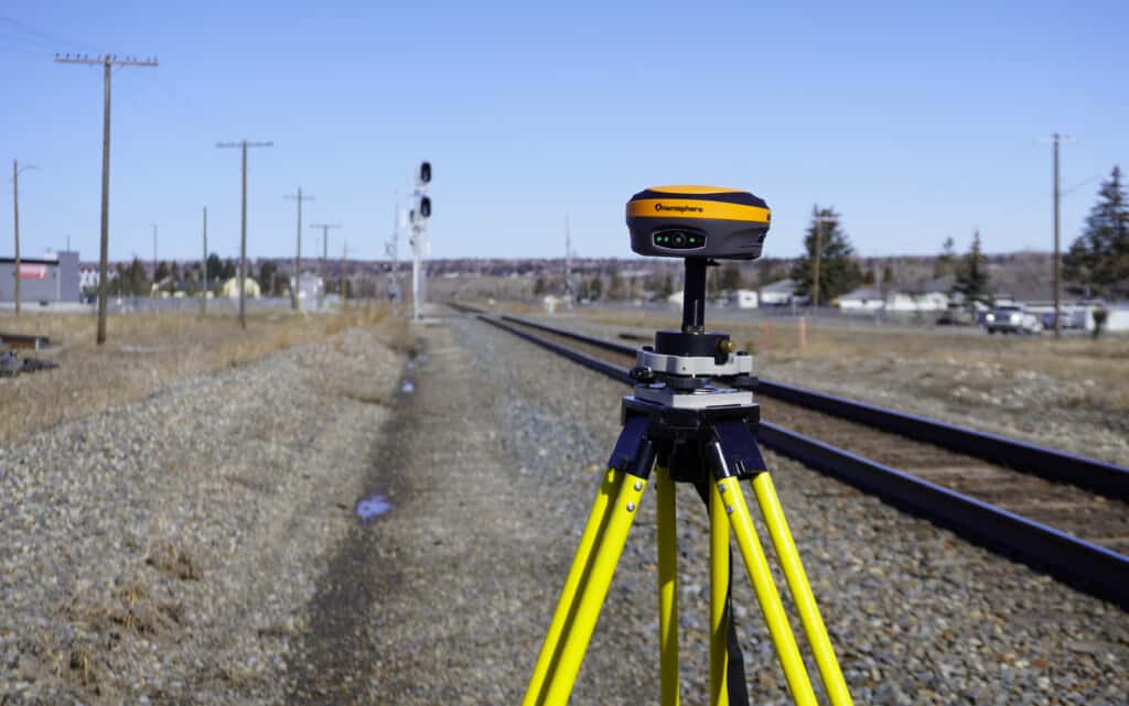
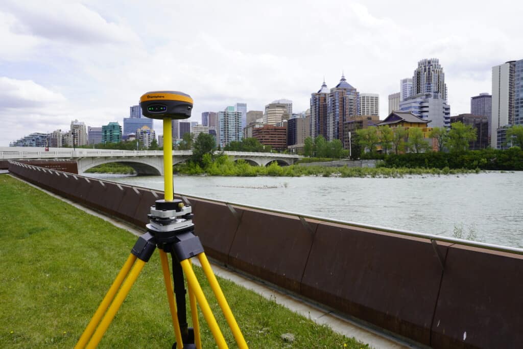
In order to test and see what the differences are between the two systems, I decided to run a bit of a test. I took a Hemisphere S631, and set it over the point we have here in the yard, and recorded data for 15 minutes. I also took data from my 2021 video on static procedures and uploaded both sets of data to both CSRS-PPP and OPUS. Below are my results.
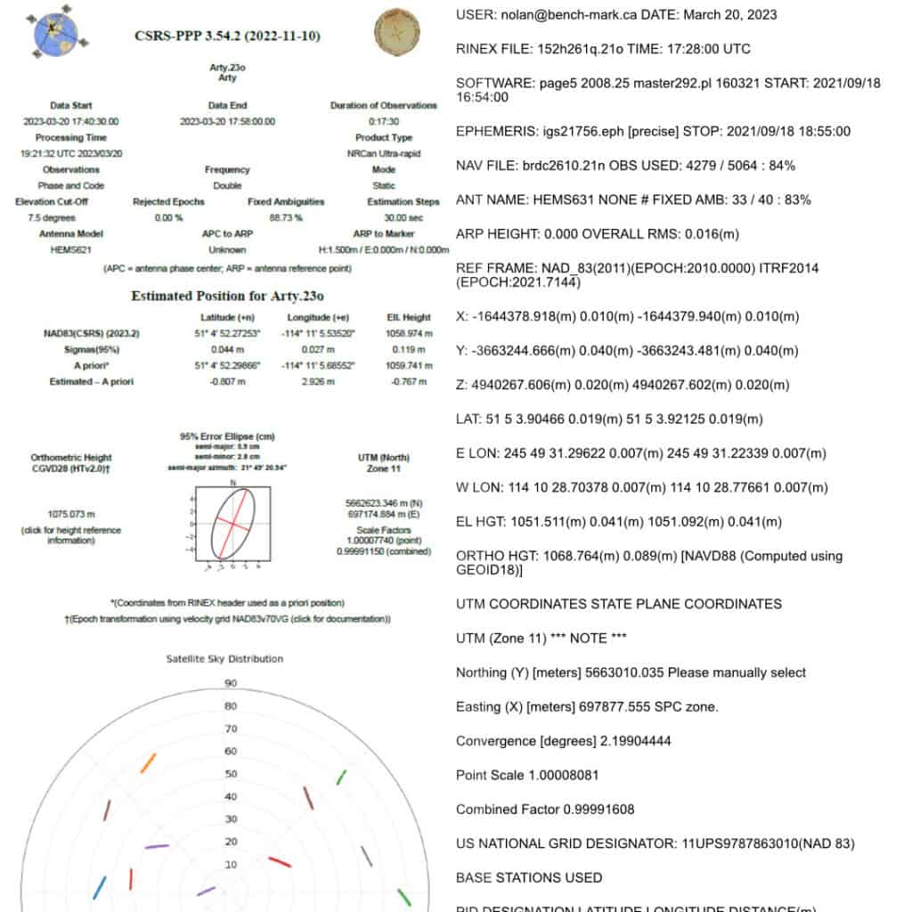
You can see that the Canadian output is significantly more visually detailed with more information on the satellite tracks. As I am writing this article from the Great White North, I only have Canadian data to process on the US processor, and this may affect the results you see here. In the two-hour time frame, both processors reported very similar results, with minimal differences in error ellipses.
Our most obvious difference in performance is the 15-minute results. On our 15-minute test, OPUS would not process the data, where as I received a result from CSRS-PPP in under 5 minutes. There could be a host of factors that cause this error, but it could also be down to the difference in available constellations. Points were recorded at different locations.
CSRS-PPP – 17 Minute Record Time
Latidude: 51° 4′ 52.27253″ (±0.044 m)
Longitude: -114° 11′ 5.68552″ (±0.027 m)
Ell. Height: 1058.974 (±0.119 m)
CSRS-PPP – 2 Hour Record Time
Latidude: 51° 5′ 3.90521″ (±0.011 m)
Longitude: -114° 10′ 28.70251″ (±0.009 m)
Ell. Height: 1051.438 (±0.031 m)
OPUS – 17 Minute Record Time
Latidude: Did Not Process
Longitude: Did Not Process
Ell. Height: Did Not Process
OPUS -2 Hour Record Time
Latidude: 51° 5′ 3.90466″ (±0.019 m)
Longitude: -114° 10′ 28.70378″ (±0.007 m)
Ell. Height: 1051.511 (±0.041 m)
However, despite what we have observed here, in what is admittedly a limited test, are different from some other reports found online. In the linked study found here: https://hrcak.srce.hr/file/385039 base stations in Turkey and the US were used to collect data then uploaded to CSRS-PPP and OPUS respectively. What was found that of the uploaded solutions, the CSRS-PPP resolved 98% of planned positions and OPUS resolved only 84% of planned positions. The below results were obtained.
The one caveat with this data set, is that the US stations were GPS only and the Turkish stations were GPS and Glonass. As well, not all stations were even dual frequency, which can cause significant issues with ionospheric interference.
Should You Use CSRS-PPP or OPUS?
From the above results, you may be getting a bit of a mixed message. From our testing, and the specifications, it would seem that CSRS-PPP is the better processing solution. However, in the Turkish test, OPUS produced better results, albeit with single frequency and limited constellation receivers. For the latest 7th generation receivers, CSRS-PPP will likely give a better result. For older L1, L2 receivers, you may be able to obtain better results with OPUS.
At the end of the day, there is no clear winner, it is fully dependent on what your needs are. If you are based in the US, OPUS is probably the better solution, as it provides outputs in local US coordinate systems. On the chance your data does not process in OPUS, you may want to try to process the data through the CSRS-PPP platform. It is worth noting that OPUS GNSS remains a reliable option for U.S.-based surveyors, especially when local coordinate system outputs are required.
Bench Mark Equipment & Supplies is your team to trust with all your surveying equipment. We have been providing high-quality surveying equipment to land surveyors, engineers, construction, airborne and resource professionals since 2002. This helps establish ourselves as the go-to team in Calgary, Canada, and the USA. Plus, we provide a wide selection of equipment, including global navigation satellite systems, RTK GPS equipment, GNSS receivers, and more. We strive to provide the highest level of customer care and service for everyone. To speak to one of our team today, call us at +1 (888) 286-3204 or email us at [email protected]
