

Real-Time Kinematic (RTK) positioning is one of the most accurate civilian satellite-based positioning techniques on today’s market. Primarily employed by engineers, surveyors and increasingly in automated positioning applications, RTK has completely changed the positioning landscape. Unlike standard GPS, which provides accuracy in the range of meters, RTK enhances positional accuracy to the centimeter level, making it indispensable for tasks requiring high precision, such as surveying, construction, and agriculture.
RTK works by using either a network of fixed base stations, or a singular base station that continuously monitor satellite signals. These base stations calculate the errors in the signals caused by atmospheric conditions and other factors and then transmit corrections to the rover units (mobile receivers) in real-time. This process allows the rover to compute its position with high accuracy relative to the base station. Over the decades, RTK has evolved significantly, becoming a critical tool in various fields where precision is paramount. This essay explores the history of RTK, focusing on the major milestones that have shaped its development.
The Evolution of Positioning Systems
Key Milestones in RTK Development
Impact on Surveying and Engineering
Challenges and Future Directions
Before the advent of satellite-based positioning systems, navigation and positioning relied on terrestrial methods such as triangulation and celestial navigation. These methods were limited by geographic and environmental factors, with potential for errors, especially when used by newer users.
The development of the Global Positioning System (GPS) in the 1970s and its full deployment by the mid-1990s revolutionized positioning and navigation. GPS, a satellite-based navigation system operated by the U.S. Department of Defense, provided global coverage and relatively accurate positioning. However, the standard GPS had limitations, offering accuracy only in the range of 5 to 10 meters under optimal conditions. This level of accuracy was insufficient for many precision-demanding applications, such as land surveying, construction, and geodetic measurements.
The need for enhanced accuracy led to the development of Differential GPS (DGPS), which uses a network of ground-based reference stations to provide corrections to GPS signals. DGPS improved accuracy to the meter level, laying the groundwork for even more precise systems. The limitations of DGPS, however, still left room for improvement, particularly in applications requiring real-time, centimeter-level accuracy.
The concept of RTK evolved from the principles of DGPS, aiming to provide real-time corrections for high-precision positioning. The late 1980s and early 1990s saw the first significant developments in RTK technology, driven by the demand for more accurate and reliable positioning solutions in real-time applications.
RTK was designed to overcome the limitations of DGPS by introducing the concept of carrier-phase correction. While DGPS relied on code-phase corrections, which had inherent inaccuracies, RTK used the phase of the carrier wave transmitted by GPS satellites. By comparing the phase of the signal received by a base station with that received by a rover unit, RTK could determine the position of the rover with much higher precision.
The initial development of RTK involved extensive research and experimentation by academic institutions, government agencies, and private companies. Organizations like the National Aeronautics and Space Administration (NASA), the U.S. Department of Defense, and various universities played critical roles in advancing the theoretical and practical aspects of RTK.
The first practical implementations of RTK began to emerge in the early 1990s, with commercial systems becoming available by the mid-1990s. These early systems were relatively complex and expensive, but they represented a significant leap forward in positioning technology, offering centimeter-level accuracy in real-time.
1980s: Introduction of Differential GPS (DGPS)
The 1980s marked the beginning of a new era in satellite-based positioning with the introduction of DGPS. DGPS was a significant improvement over standard GPS, providing corrections that improved accuracy from meters to decimeters. This period laid the foundation for the development of RTK, as it highlighted the need for even greater precision in real-time applications.
Early 1990s: First Practical Implementations of RTK
The early 1990s saw the first practical implementations of RTK, leveraging advances in GPS technology and signal processing. These early RTK systems used single-frequency GPS receivers and were capable of providing centimeter-level accuracy under optimal conditions. However, they were limited by factors such as the need for line-of-sight between the rover and base station and the relatively slow data processing capabilities of the time.
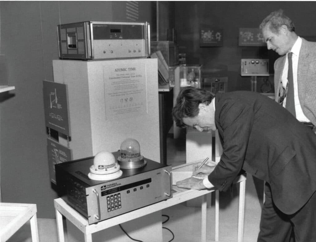
1994: Commercial Availability of RTK Systems
By 1994, RTK technology had advanced to the point where it became commercially available. Companies like Trimble, Leica Geosystems, and Ashtech began offering RTK systems to professional surveyors and engineers. These systems typically included a base station, a rover unit, and a communication link between the two. The commercial availability of RTK systems marked a significant milestone, making high-precision positioning accessible to a broader range of users.
Late 1990s: Advancements in Algorithms and Data Processing
The late 1990s saw significant advancements in the algorithms and data processing techniques used in RTK systems. These improvements allowed for faster initialization times, better handling of signal obstructions, and increased reliability. The introduction of dual-frequency receivers, which could process signals from both the L1 and L2 GPS bands, further enhanced the accuracy and robustness of RTK.
During this period, RTK systems also began to incorporate more sophisticated communication technologies, such as radio modems and cellular networks, to transmit correction data from the base station to the rover. This allowed for greater flexibility in the deployment of RTK systems, as users were no longer limited by the range of traditional line-of-sight communication methods.
2000s: Integration with Global Networks and Real-Time Data Exchange
In the 2000s, RTK technology began to integrate with global navigation satellite systems (GNSS), including the Russian GLONASS, European Galileo, and Chinese BeiDou systems. This multi-constellation approach improved the availability and accuracy of RTK positioning, especially in challenging environments where GPS signals alone might be obstructed or degraded.
Additionally, the 2000s saw the development of network RTK (NRTK) systems, which utilized a network of multiple base stations to provide real-time corrections over a wide area. NRTK systems, such as the Virtual Reference Station (VRS) concept, allowed users to achieve centimeter-level accuracy without the need for a dedicated local base station. This development greatly expanded the usability of RTK in regions with established NRTK infrastructure.
2010s: RTK Network Densification and the Rise of Precise Point Positioning (PPP)
The 2010s were characterized by the densification of RTK networks and the increasing availability of real-time correction services. Governments and private companies invested heavily in expanding RTK infrastructure, creating dense networks of base stations that provided coverage over vast geographic areas.
During this decade, the concept of precise point positioning (PPP) also gained traction. PPP is a satellite-based positioning method that provides centimeter-level accuracy without the need for a local base station or network of base stations. While RTK relies on real-time corrections from a base station, PPP uses precise satellite orbit and clock data, making it a more versatile solution in areas where RTK infrastructure is limited. Services like NRCAN’s PPP service are great free services that employ this technology.
However, PPP typically requires longer convergence times than RTK, and its accuracy can be affected by factors such as atmospheric conditions and satellite geometry. Despite these limitations, the combination of RTK and PPP offers a powerful toolkit for engineers and surveyors, providing flexibility and precision in a wide range of applications.
2020s: Modern Innovations, Multi-Frequency, and Multi-Constellation RTK
The 2020s have brought further innovations in RTK technology, with a focus on multi-frequency and multi-constellation systems. Modern RTK systems can now process signals from multiple GNSS constellations and across multiple frequency bands, improving accuracy, reliability, and robustness, especially in challenging environments.
Additionally, advances in data processing algorithms and machine learning have enhanced the ability of RTK systems to quickly resolve ambiguities and provide high-precision positioning even in the presence of signal obstructions or interference. The integration of RTK with other technologies, such as inertial navigation systems (INS) and real-time kinematic light detection and ranging (RTK-LiDAR), has further expanded the capabilities and applications of RTK.
These modern RTK systems are also becoming more accessible to a broader range of users, thanks to the increasing availability of affordable hardware and cloud-based correction services. As a result, RTK is now used not only in traditional surveying and engineering applications but also in emerging fields such as autonomous vehicles, drones, and precision agriculture.
The development of RTK has had a profound impact on the fields of surveying and engineering, transforming how professionals approach positioning and measurement tasks. Before RTK, surveyors relied on traditional methods, such as total stations and theodolites, which required extensive time and effort to achieve the desired level of accuracy.
With the advent of RTK, surveyors can now achieve centimeter-level accuracy in real-time, significantly reducing the time and labor required for fieldwork. This has led to increased efficiency and productivity in surveying projects, allowing surveyors to cover larger areas in less time and with greater precision.
In construction, RTK has enabled the precise positioning of machinery and materials, ensuring that structures are built according to design specifications. RTK-guided machines, such as excavators and bulldozers, can automatically adjust their position and orientation based on real-time corrections, reducing the need for manual intervention and minimizing errors.
Agriculture has also benefited from RTK technology, particularly in precision farming applications. Farmers use RTK-guided tractors and machinery to plant, fertilize, and harvest crops with high precision, optimizing yields and reducing waste. The ability to precisely map and manage fields has led to more efficient use of resources, such as water, fertilizers, and pesticides, contributing to sustainable agricultural practices.
RTK has also played a critical role in geospatial data collection, enabling the creation of highly accurate digital maps and models. Surveyors and engineers use RTK-equipped drones and mobile mapping systems to capture detailed geospatial data for a wide range of applications, including urban planning, environmental monitoring, and disaster response.

RTK is not just used in surveying and construction. By employing RTK in conjugation with Search and Rescue drones, rescuers can get a more precise position of the drone in the terrain. Above the DJI Matrice 350 is pictured in the SAR configuration.
GNSS forms the foundational layer that makes RTK possible. RTK positioning depends on continuous satellite observations from global navigation satellite systems to calculate precise distances between satellites, base stations, and rover receivers. Without GNSS signals, RTK would have no reference data from which to generate real-time corrections.
Modern GNSS RTK positioning benefits from access to multiple satellite constellations, including GPS, GLONASS, Galileo, and BeiDou. Tracking signals from several constellations improves satellite geometry, increases redundancy, and reduces the likelihood of signal loss in difficult environments such as urban areas or under partial canopy.
Traditional satellite-based GNSS RTK positioning methods rely on standalone GNSS measurements, which typically result in meter-level accuracy. RTK distinguishes itself by using correction data to remove common GNSS errors (such as satellite clock drift and atmospheric delays) in real time.
Another defining difference is immediacy. Unlike post-processed workflows that require data correction after fieldwork is completed, RTK delivers high-precision results instantly. This real-time capability allows surveyors and engineers to verify measurements on-site and make immediate decisions based on accurate positioning data.
RTK also provides superior repeatability compared to traditional positioning methods. When the same reference source is used, positions collected at different times align consistently. This consistency is critical for boundary surveys, construction layout, and control point establishment. Because of this reliability, RTK has become the standard for applications that require centimeter-level accuracy.
Despite its many advantages, RTK technology is not without its challenges. One of the primary limitations of RTK is its dependency on line-of-sight communication between the receiver and satellites. In environments with significant obstructions, such as urban canyons or dense forests, maintaining a reliable connection can be difficult, leading to degraded accuracy or loss of positioning data. Newer 7th generation receivers, like the Hemisphere S631 are specifically designed to better perform in these conditions.
Atmospheric conditions, such as ionospheric and tropospheric disturbances, can also affect the accuracy of RTK positioning. While modern RTK systems use advanced algorithms to mitigate these effects, they can still introduce errors in certain conditions.
Looking ahead, the future of RTK technology is likely to involve further integration with emerging technologies, such as 5G networks and cloud computing, to enhance real-time data exchange and processing capabilities. The continued development of multi-frequency and multi-constellation systems will also improve the reliability and accuracy of RTK in challenging environments.
In addition, the growing demand for autonomous systems, such as self-driving cars and drones, is likely to drive further innovation in RTK technology. These systems require precise and reliable GNSS RTK positioning to navigate safely and effectively, making RTK a critical component of their operation.
The history of RTK technology is a story of continuous innovation and improvement, driven by the need for greater accuracy and reliability in positioning systems. From its early beginnings as an enhancement to GPS, RTK has evolved into a sophisticated and indispensable tool for engineers and surveyors.
The key milestones in RTK development, from the introduction of DGPS in the 1980s to the modern multi-frequency, multi-constellation systems of the 2020s, highlight the significant progress that has been made in the field of satellite-based positioning. RTK has transformed the way professionals approach surveying, construction, agriculture, and geospatial data collection, providing the precision and reliability needed for today’s demanding applications.
As RTK technology continues to evolve, it is likely to play an even more significant role in the future, particularly in the context of autonomous systems and smart infrastructure. While challenges remain, the ongoing advancements in RTK and related technologies promise to further enhance the capabilities and applications of this powerful positioning tool.
RTK (Real-Time Kinematic) positioning is a high-precision satellite-based navigation technique that provides centimeter-level accuracy, unlike standard GPS, which only offers accuracy within a range of meters. RTK achieves this by using corrections from a base station to minimize signal errors in real-time.
RTK relies on one or more fixed base stations that track satellite signals and calculate errors. These corrections are then transmitted to mobile rover units in real-time, allowing them to determine their position with high accuracy relative to the base station.
Some key milestones include the introduction of Differential GPS (DGPS) in the 1980s, the commercial availability of RTK systems in the 1990s, advancements in algorithms and multi-frequency systems in the 2000s, and the integration with global satellite networks in recent years.
RTK is widely used in surveying, construction, precision agriculture, and autonomous systems like drones and self-driving cars, where high positional accuracy is crucial for tasks like mapping, machine guidance, and resource optimization.
RTK positioning can be affected by environmental obstructions (e.g., dense forests, urban areas), line-of-sight issues between satellites, and atmospheric disturbances. Newer technology, such as multi-frequency receivers, helps address some of these challenges.
Bench Mark Equipment & Supplies is your team to trust with all your surveying equipment. We have been providing high-quality surveying equipment to land surveyors, engineers, construction, airborne and resource professionals since 2002. This helps establish ourselves as the go-to team in Calgary, Canada, and the USA. Plus, we provide a wide selection of equipment, including global navigation satellite systems, RTK GPS equipment, GNSS receivers, and more. We strive to provide the highest level of customer care and service for everyone. To speak to one of our team today, call us at +1 (888) 286-3204 or email us at [email protected]
