

Since the introduction of Global Navigation Satellite Systems (GNSS) has shepherded in an era of unparalleled GNSS accuracy and reliability in determining precise locations across the world. However, not all GNSS receivers achieve the same level of accuracy. It is important to understand the difference between Real-Time Kinematics (RTK), Differential GPS (DGPS), L-band 10 cm accuracy systems like Hemisphere’s Atlas, and autonomous systems as they can make or break your survey.
RTK stands atop the GNSS accuracy options, relying upon a base and rover tandem to achieve centimeter-level rtk gps accuracy in real-time. You will most often find RTK receiver in fields where high absolute accuracy is needed, such as land surveying, construction layout, and precision agriculture. In a tier slightly below, DGPS steps in, using additional regional satellites to correct errors in GNSS signals received by the receiver, elevating standard GPS accuracy levels to sub-meter or decimeter levels. Relying upon clear views of the sky, DGPS is most often used in marine navigation, geodetic surveying, and agricultural machinery guidance where enhanced, though not pinpoint, accuracy is essential. Similarly, L-Band systems, like Hemisphere’s Atlas, leveraging satellite-based augmentation to achieve reliable centimeter-level rtk gps accuracy globally, amplifying its significance in construction, machine control, and precision agriculture realms. Lastly, autonomous accuracy systems, operating without external correction signals, giving accuracies to within a few meters, catering to applications in consumer-grade navigation, fitness tracking, and general mapping where exact centimeter-level precision may not be critical but reliable positioning remains essential.
Not every GNSS receiver delivers the same level of positioning performance. The level of accurate GNSS positioning depends largely on whether corrections are applied and which correction technology is used.
The table below compares the most common GNSS accuracy levels.
| Positioning Method | Typical Accuracy | Convergence Time | Coverage Area | Best Applications |
| Autonomous GNSS | 1–3 m | Instant | Global | Navigation, fitness tracking, asset tracking |
| SBAS | 1–3 m | Seconds | Regional | Aviation, marine navigation, GIS mapping |
| DGPS | Sub-meter to 1 m | Seconds | Regional | Agriculture, GIS data collection |
| PPP | 5–20 cm | 10–30 minutes | Global | Offshore operations, remote surveying |
| L-Band Corrections | 4–10 cm | Minutes | Global | Construction, machine control, agriculture |
| RTK | 1–2 cm | Seconds | Local or Network Coverage | Surveying, construction layout, machine guidance |
Autonomous positioning provides the lowest level of GPS unit accuracy, relying solely on signals received from satellites. SBAS and DGPS improve performance by applying regional corrections, while PPP and L-Band services provide decimeter- to centimeter-level positioning across large geographic areas.
For applications requiring the highest RTK GNSS accuracy, RTK remains the industry benchmark. By combining carrier-phase measurements with real-time corrections from a base station or RTK network, users can consistently achieve centimeter-level positioning in real-world field conditions.
Correction services are designed to remove errors caused by satellite clocks, orbital inaccuracies, atmospheric delays, and signal disturbances. The correction method used has a direct impact on achievable positioning accuracy.
| Correction Method | Typical Accuracy | Convergence Time | Coverage | How It Works |
| SBAS | 1–3 m | Seconds | Continental | Satellite-based regional corrections |
| DGPS | Sub-meter | Seconds | Regional | Corrections from reference stations |
| PPP | 5–20 cm | 10–30 min | Global | Precise orbit and clock modeling |
| PPP-RTK | 3–7 cm | Seconds to minutes | Wide-area | PPP combined with atmospheric modeling |
| RTK | 1–2 cm | Seconds | Local or Network Coverage | Carrier-phase corrections from nearby base stations |
Satellite-Based Augmentation Systems such as WAAS, EGNOS, and MSAS use networks of reference stations to calculate corrections that are broadcast through geostationary satellites. SBAS improves positioning accuracy without requiring additional field infrastructure.
Precise Point Positioning uses globally generated satellite orbit and clock corrections to improve positioning performance. PPP can achieve impressive accuracy worldwide but generally requires a longer convergence period before reaching peak performance.
PPP-RTK combines PPP satellite corrections with regional atmospheric models, significantly reducing convergence time while maintaining high accuracy over large geographic regions.
RTK delivers the highest level of real-time positioning accuracy by transmitting carrier-phase corrections from a base station or RTK network directly to the rover. This makes RTK the preferred solution for surveying, construction staking, and machine control applications where maximum precision is required.
Several factors influence GNSS positioning performance regardless of the receiver or correction method being used.
As GNSS signals travel through the ionosphere and troposphere, signal delays are introduced that can reduce positioning accuracy. Correction services help model and remove much of this error.
Multipath occurs when signals reflect off buildings, vehicles, water surfaces, or other structures before reaching the receiver. These reflected signals can distort distance calculations and reduce positioning reliability.
The relative position of satellites in the sky directly affects solution quality. Widely distributed satellites provide stronger geometry and more reliable positioning than satellites clustered in one area.
This concept is measured using Dilution of Precision (DOP). Lower DOP values generally indicate stronger positioning geometry and improved accuracy.
Trees, buildings, terrain, and infrastructure can block satellite signals or reduce the number of satellites available to the receiver.
Modern multi-frequency, multi-constellation receivers can track significantly more satellite signals than older GPS-only units, improving reliability and positioning performance.
The correction service selected has one of the largest impacts on achievable accuracy. Autonomous positioning may achieve meter-level accuracy, while RTK can routinely achieve centimeter-level precision.
Receivers capable of tracking GPS, GLONASS, Galileo, and BeiDou simultaneously benefit from improved satellite availability and stronger geometry, resulting in more consistent and accurate GNSS positioning.
Even the most advanced GNSS systems are subject to a range of factors that can degrade positioning accuracy in the field. Atmospheric conditions are among the most common culprits, signals passing through the ionosphere and troposphere experience delays that introduce errors into distance calculations.
Satellite geometry also plays a role; when visible satellites are clustered together in the sky rather than spread out, the receiver has less information to work with, which weakens the quality of the position fix.
Signal multipath is another frequent source of error, occurring when GNSS signals bounce off surfaces such as buildings, vehicles, or water before reaching the receiver. This causes the receiver to process reflected signals alongside direct ones, distorting the calculated position. In urban environments or near large structures, multipath can be a persistent challenge.
Improving GNSS accuracy typically involves adding a layer of correction to the raw signal. Techniques such as RTK, DGPS, and L-band augmentation each address these error sources in different ways, as covered throughout this article.
Beyond choosing the right correction method, accuracy can also be improved by using multi-constellation receivers, selecting open sky locations with minimal obstructions, reducing baseline distances, and integrating inertial measurement units (IMUs) where signal conditions are difficult.
Real-Time Kinematics is a high-precision satellite navigation technique that stands at the forefront of accurate GNSS positioning systems. Its fundamental principle involves the use of a base station and a rover, both equipped with GNSS receivers. The base station, typically located at a known position, receives signals from satellites in the GNSS constellation. This information is transmitted to the rover where the RTK magic happens.
Base Station: The base station precisely determines its position by calculating the phase differences of the satellite signals it receives. It continuously monitors these signals and computes corrections for errors caused by factors like atmospheric disturbances and satellite clock drift.
Rover: Simultaneously, the rover, which could be a moving vehicle or a handheld device, receives satellite signals and correction data from the base station in real-time. By integrating the correction information received from the base station, the rover corrects its own position calculations, significantly enhancing its accuracy.
RTK technology enables centimeter-level accuracy by exploiting phase measurements of carrier signals from GNSS satellites. The corrections provided by the base station are transmitted to the rover with minimal latency, allowing for highly precise positioning even in dynamic environments.
Applications of RTK
RTK finds extensive use in applications that demand utmost accuracy, such as:
Surveying and Mapping: Land surveyors rely on RTK for precise measurements in construction layout, topographic mapping, and boundary delineation.
Precision Agriculture: Farmers use RTK for precise guidance of agricultural machinery, allowing for optimal seed planting, fertilizer application, and crop monitoring.
Construction and Engineering: In construction projects, RTK assists in accurate site preparation, grading, and building layout.
While RTK offers unparalleled accuracy, it is sensitive to signal obstructions and multipath errors, particularly in urban areas with tall buildings or dense foliage. Additionally, the need for a continuous communication link between the base station and rover limits its operational range.
Ongoing advancements in RTK technology aim to mitigate its limitations. Innovations such as multi-constellation support (utilizing signals from multiple satellite systems like GPS, GLONASS, Galileo, and BeiDou), enhanced algorithms for error correction, and integration with inertial measurement units (IMUs) are expanding the capabilities and robustness of RTK systems.
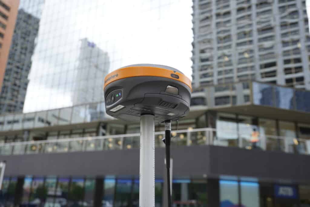
The latest 7th generation RTK receivers like Hemisphere’s S631 can achieve accurate positioning even in difficult environments where signals are less than ideal. Such as those found under trees and near buildings. Check out this video where we tested the repeatability of the Hemisphere S631’s RTK positioning under trees.
Real-Time Kinematics remains a cornerstone of precision positioning, continually evolving to meet the demands of various industries requiring centimeter-level accuracy in dynamic environments.
While GPS is a single constellation system, GNSS encompasses multiple satellite constellations, including GPS, GLONASS, Galileo, and BeiDou. Multi-constellation GNSS systems generally provide higher gnss accuracy due to increased satellite visibility, redundancy, and better geometry. GPS alone can achieve excellent accuracy, but the integration of additional constellations improves positioning reliability and reduces errors caused by obstructions or poor satellite geometry.
Differential GPS serves as a practical and cost-effective method to enhance the accuracy of standard GPS systems. It operates on the principle of comparing the signals received from GPS satellites at a stationary reference station with those received at a mobile unit, correcting for errors and significantly improving positional accuracy.
Reference Station: A stationary reference station with a known location continuously receives signals from GPS satellites. This station precisely calculates its own position and simultaneously measures any errors in the signals it receives.
Mobile Unit: The mobile unit, which could be a vehicle or handheld device, receives signals from the same satellites but experiences similar errors due to atmospheric conditions and signal disturbances.
Error Correction: By comparing the signals received at the reference station with those received by the mobile unit, DGPS calculates and transmits correction data to the mobile unit, effectively mitigating errors caused by factors like ionospheric and tropospheric effects, satellite clock drift, and ephemeris errors.
DGPS significantly enhances GPS accuracy, reducing positional errors from the standard GPS accuracy of several meters down to sub-meter or decimeter levels (in the case of Galileo’s new HAS service). This level of accuracy makes it suitable for applications where high precision, but not necessarily centimeter-level accuracy, is required.
Marine Navigation: DGPS is extensively used in maritime operations for precise vessel positioning, aiding in safe navigation, docking, and offshore operations.
Geodetic Surveying and Mapping: Surveyors and cartographers utilize DGPS for accurate mapping, land surveying, and geodetic applications where moderate accuracy is sufficient.
Agricultural Machinery Guidance: In farming, DGPS assists in guiding machinery for planting, spraying, and harvesting, optimizing field operations.
While DGPS offers improved accuracy, it requires a reference station at a known location within range of the mobile unit. This limitation restricts its use in areas were establishing or maintaining a reference station network is challenging, such as remote or sparsely populated regions.
DGPS continues to evolve with advancements in technology. Integration with other positioning techniques, such as RTK and augmentation systems like SBAS (Satellite-Based Augmentation Systems), extends its capabilities and coverage, overcoming some of its limitations.
Commonly, DGPS receivers are used in GIS applications. Receivers like Juniper’s Geode are perfect for applications where sub-meter accuracy is desired, while keeping the receiver as small and compact as possible.
Differential GPS stands as a reliable solution for achieving higher accuracy in positioning systems, offering a balance between precision and cost-effectiveness across various industries and applications.
L-band technology, epitomized by services like Hemisphere’s Atlas, represents a significant stride in augmenting GNSS accuracy to achieve reliable centimeter-level precision globally. By harnessing satellite-based augmentation systems, L-band services offer a substantial leap in accuracy, catering to industries reliant on precise positioning for optimal operations.
Satellite-Based Augmentation: Hemisphere’s Atlas utilizes satellite-based augmentation systems to enhance GNSS accuracy. These systems employ geostationary satellites to broadcast correction signals, compensating for errors present in GNSS signals received by the user’s receiver.
Correction Signals: These correction signals contain precise data that mitigate errors arising from factors such as ionospheric disturbances, satellite clock deviations, and orbit inaccuracies, enabling the user’s receiver to refine its position calculations.
Hemisphere’s Atlas, among other L-band services, ensures a consistent, centimeter-level accuracy on a global scale. By amalgamating data from multiple GNSS constellations like GPS, GLONASS, Galileo, and BeiDou, and employing sophisticated correctional algorithms, this technology transcends geographical boundaries, delivering reliable positioning information with unprecedented precision.
Construction and Machine Control: In construction and heavy machinery operations, where precision is paramount, L-band technology aids in precise grading, excavation, and machine guidance, optimizing efficiency and reducing rework.
Precision Agriculture: Farmers leverage L-band services for accurate crop monitoring, variable rate application of fertilizers and pesticides, and autonomous machinery guidance, enhancing productivity and resource management.
Surveying and Infrastructure Development: Surveyors and engineers rely on L-band accuracy for precise mapping, land development, and infrastructure construction, ensuring accuracy in design and implementation.
While L-band technology significantly enhances accuracy, it may face limitations in heavily obstructed environments or areas with signal interferences. Continuous advancements in satellite technology, integration of additional constellations, and refined algorithms aim to overcome these limitations, further bolstering the reliability and coverage of L-band systems.
Hemisphere’s Atlas and similar L-band services stand as pillars of accuracy, empowering various industries with the precision necessary for critical operations, fostering efficiency, and elevating productivity while setting new benchmarks in global positioning accuracy.
Autonomous positioning refers to the use of GPS/GNSS receivers without external corrections or augmentation systems to determine the user’s position. Unlike RTK or DGPS, which rely on additional data for error correction, autonomous systems work solely based on signals received directly from satellites.
Satellite Signals: GPS/GNSS receivers capture signals transmitted by satellites orbiting the Earth. These signals contain information used to calculate the receiver’s position based on the distances from multiple satellites.
Triangulation: Using trilateration or multilateration techniques, the receiver determines its position by calculating the intersection of spheres or hyperboloids representing distances from each satellite.
Error Sources: Autonomous positioning faces inherent errors due to factors like atmospheric disturbances, signal reflections (multipath), satellite geometry, and clock inaccuracies. These errors typically result in accuracy within a few meters.
Autonomous positioning systems offer moderate accuracy, typically within a range of 1 to 3 meters. This level of accuracy suffices for many everyday applications where precise centimeter-level details aren’t critical.
Consumer Navigation: GPS devices in smartphones and car navigation systems use autonomous positioning to provide users with accurate location information for directions, mapping, and location-based services.
Fitness and Activity Tracking: Wearable devices equipped with GPS/GNSS capabilities track outdoor activities, providing users with data on distance covered, speed, and routes.
General Mapping and GIS: Autonomous positioning aids in general mapping applications, geographic information systems (GIS), and location tagging in photography and social media.
Limited Precision: The accuracy of autonomous positioning systems, while sufficient for many applications, falls short in scenarios that demand centimeter-level precision.
Vulnerability to Signal Blockage: Signal obstructions caused by tall buildings, dense foliage, or indoor environments can degrade accuracy or even disrupt satellite signal reception, impacting position determination.
Potential for Error Accumulation: Over extended periods or long distances, autonomous systems may accumulate errors, affecting the accuracy of continuous tracking.
Advancements in GPS/GNSS technology, including the integration of multiple satellite constellations (e.g., GPS, GLONASS, Galileo, BeiDou) and improved receiver algorithms, aim to enhance the accuracy and reliability of autonomous positioning systems. Additionally, developments in sensor fusion with inertial measurement units (IMUs) contribute to better positioning accuracy, especially in challenging environments.
Autonomous positioning systems serve as the backbone for everyday location-based applications, offering reliable accuracy suitable for a wide range of consumer and commercial purposes.
The ideal positioning method depends on the accuracy requirements of the project.
| Application | Recommended Method |
| Land Surveying | RTK |
| Construction Layout | RTK |
| Machine Control | RTK or L-Band |
| Precision Agriculture | RTK or L-Band |
| GIS Mapping | DGPS or SBAS |
| Marine Navigation | DGPS or PPP |
| Asset Tracking | Autonomous GNSS or DGPS |
Land surveyors and construction professionals typically require centimeter-level positioning, making RTK the preferred choice. For machine control and precision agriculture, both RTK and advanced L-Band correction services provide highly accurate results.
GIS professionals often find sub-meter DGPS accuracy sufficient for data collection projects, while marine navigation benefits from the broad coverage offered by DGPS and PPP services.
Asset tracking and consumer navigation applications generally prioritize coverage, simplicity, and cost over maximum precision, making autonomous GNSS positioning appropriate for most deployments.
In the realm of Global Navigation Satellite Systems (GNSS), varying accuracy levels cater to distinct needs. Real-Time Kinematics (RTK) provides centimeter-level precision crucial in surveying and precision agriculture. Differential GPS (DGPS) enhances standard GPS accuracy for applications like maritime navigation and geodetic surveying.
L-band technology, exemplified by Hemisphere’s Atlas, delivers reliable centimeter-level accuracy globally, benefiting construction, machine control, and precision agriculture. Autonomous positioning offers moderate accuracy within a few meters, serving consumer navigation and everyday applications.
Advancements, including multi-constellation integration and improved algorithms, promise expanded accuracy and coverage. Understanding these GNSS accuracy levels empowers users to select optimal technology for diverse needs, shaping progress and innovation across industries.
RTK GPS offers centimeter-level accuracy in real-time, significantly improving upon standard GPS, which typically provides accuracy within 1–3 meters without corrections. Using RTK, surveyors can achieve horizontal accuracies of 8–10 mm and vertical accuracies around 15 mm under ideal conditions.
GNSS is generally more accurate than GPS alone because it uses multiple satellite constellations, providing better coverage, reducing errors, and improving redundancy. While GPS is a subset of GNSS, multi-constellation GNSS receivers typically deliver superior gnss accuracy.
RTK GPS precision reaches centimeter-level, with horizontal precision often around 8–10 mm and vertical precision approximately 15 mm. This high precision makes RTK ideal for surveying, construction, and precision agriculture.
RTK GPS altitude (vertical) accuracy is typically within 1–2 cm for short baselines but can vary slightly with longer baselines or challenging environments. Proper setup and a clear line of sight to multiple satellites are critical for maintaining optimal vertical rtk gps accuracy.
RTK GPS is highly sensitive to signal obstructions, multipath errors, and requires a continuous communication link between base and rover. Environmental factors like dense foliage, urban canyons, or tall buildings can degrade accuracy. Additionally, RTK setups are more complex and require more equipment than standard GPS.
Accuracy can be improved by using multi-constellation GNSS receivers, selecting optimal base station locations, minimizing obstructions, using longer observation times if possible, and integrating augmentation systems or inertial measurement units (IMUs). Ensuring proper calibration and reducing baseline distances also enhances rtk gps accuracy.
RTK is the most accurate method, delivering centimeter-level precision in real-time through a base station and rover setup. Where RTK infrastructure isn’t available, L-band services like Hemisphere’s Atlas offer a reliable centimeter-level alternative globally. DGPS achieves sub-meter to decimeter accuracy, making it suitable for general navigation and mapping but not for work requiring tight tolerances.
Tall buildings block direct lines of sight to satellites, reducing signal availability and weakening position geometry. Signals that do reach the receiver often arrive as reflections off surrounding surfaces (known as multipath) causing distance miscalculations. Together, these factors can significantly degrade accuracy compared to open-sky conditions.
Good GNSS accuracy depends on the application. Consumer navigation systems typically operate within 1–3 meters, while professional surveying systems often require centimeter-level accuracy. For most professional geospatial work, sub-meter accuracy is considered good, while RTK users generally expect 1–2 cm positioning performance.
Uncorrected GNSS positioning typically achieves between 1 and 5 meters of horizontal accuracy under open-sky conditions. Actual performance varies based on satellite geometry, atmospheric conditions, receiver quality, and environmental obstructions.
Yes. RTK generally provides higher real-time accuracy and faster initialization than PPP. RTK commonly achieves 1–2 cm accuracy within seconds, while PPP typically reaches decimeter- or centimeter-level accuracy after a convergence period that can range from several minutes to half an hour.
Dilution of Precision (DOP) is a measure of satellite geometry quality. Lower DOP values indicate satellites are well distributed across the sky and generally result in more reliable positioning solutions. Higher DOP values indicate weaker geometry and increased uncertainty.
A minimum of four satellites is required to calculate a three-dimensional position. However, professional GNSS receivers typically track dozens of satellites across multiple constellations simultaneously. More satellites generally improve positioning reliability, reduce DOP values, and increase overall accuracy.
Bench Mark Equipment & Supplies is your team to trust with all your surveying equipment. We have been providing high-quality surveying equipment to land surveyors, engineers, construction, airborne and resource professionals since 2002. This helps establish ourselves as the go-to team in Calgary, Canada, and the USA. Plus, we provide a wide selection of equipment, including global navigation satellite systems, RTK GPS equipment, GNSS receivers, and more. We strive to provide the highest level of customer care and service for everyone. To speak to one of our team today, call us at +1 (888) 286-3204 or email us at [email protected]
